You are here: Home > Network List > AZ - ANZA Regional Network Stations List
> Station SMER AZ.SMER > Earthquake Result Viewer
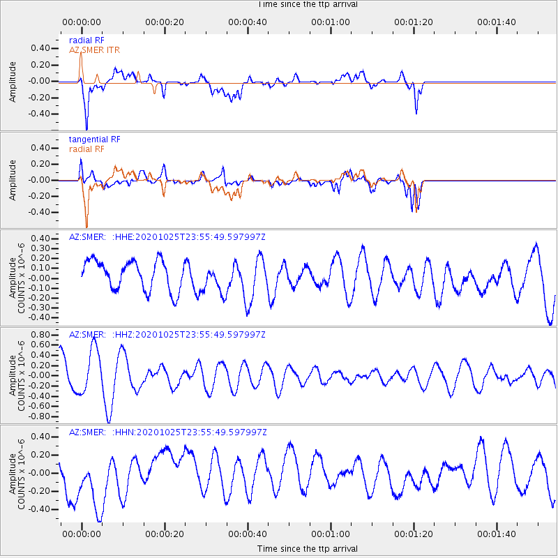
SMER AZ.SMER - Earthquake Result Viewer
*The percent match for this event was below the threshold and hence no stack was calculated.
| Earthquake location: |
Pacific-Antarctic Ridge |
| Earthquake latitude/longitude: |
-56.7/-141.7 |
| Earthquake time(UTC): |
2020/10/25 (299) 23:43:11 GMT |
| Earthquake Depth: |
10 km |
| Earthquake Magnitude: |
5.5 Mww |
| Earthquake Catalog/Contributor: |
NEIC PDE/us |
|
| Network: |
AZ ANZA Regional Network |
| Station: |
SMER AZ.SMER |
| Lat/Lon: |
33.46 N/117.17 W |
| Elevation: |
355 m |
|
| Distance: |
92.2 deg |
| Az: |
20.309 deg |
| Baz: |
193.224 deg |
| Ray Param: |
$rayparam |
*The percent match for this event was below the threshold and hence was not used in the summary stack. |
|
| Radial Match: |
51.95968 % |
| Radial Bump: |
400 |
| Transverse Match: |
55.1503 % |
| Transverse Bump: |
400 |
| SOD ConfigId: |
22732711 |
| Insert Time: |
2020-11-08 23:44:45.472 +0000 |
| GWidth: |
2.5 |
| Max Bumps: |
400 |
| Tol: |
0.001 |
|
Signal To Noise
| Channel | StoN | STA | LTA |
| AZ:SMER: :HHZ:20201025T23:55:49.597997Z | 1.2948493 | 4.490476E-7 | 3.4679528E-7 |
| AZ:SMER: :HHN:20201025T23:55:49.597997Z | 2.9666846 | 3.519477E-7 | 1.18633345E-7 |
| AZ:SMER: :HHE:20201025T23:55:49.597997Z | 0.9980503 | 1.4636838E-7 | 1.4665432E-7 |
| Arrivals |
| Ps | |
| PpPs | |
| PsPs/PpSs | |


