You are here: Home > Network List > TA - USArray Transportable Network (new EarthScope stations) Stations List
> Station E20K Nigu River, AK, USA > Earthquake Result Viewer
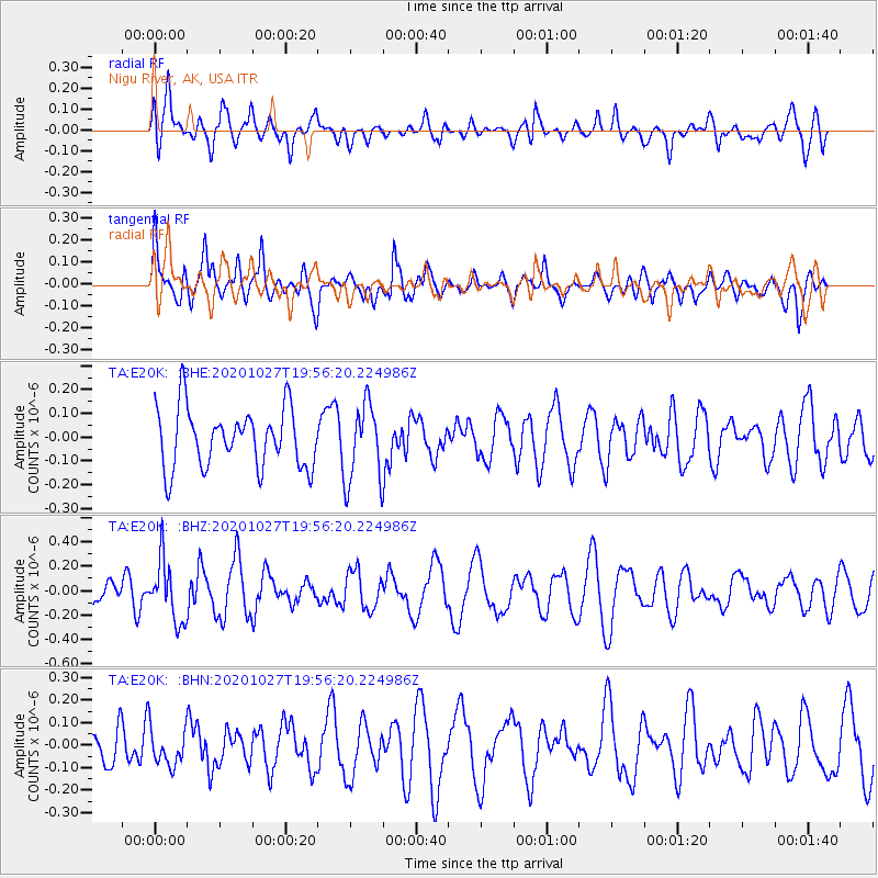
E20K Nigu River, AK, USA - Earthquake Result Viewer
*The percent match for this event was below the threshold and hence no stack was calculated.
| Earthquake location: |
Sulawesi, Indonesia |
| Earthquake latitude/longitude: |
-2.2/119.1 |
| Earthquake time(UTC): |
2020/10/27 (301) 19:43:52 GMT |
| Earthquake Depth: |
17 km |
| Earthquake Magnitude: |
5.5 Mww |
| Earthquake Catalog/Contributor: |
NEIC PDE/us |
|
| Network: |
TA USArray Transportable Network (new EarthScope stations) |
| Station: |
E20K Nigu River, AK, USA |
| Lat/Lon: |
68.26 N/156.19 W |
| Elevation: |
866 m |
|
| Distance: |
90.1 deg |
| Az: |
21.777 deg |
| Baz: |
264.259 deg |
| Ray Param: |
$rayparam |
*The percent match for this event was below the threshold and hence was not used in the summary stack. |
|
| Radial Match: |
43.30069 % |
| Radial Bump: |
400 |
| Transverse Match: |
65.51944 % |
| Transverse Bump: |
400 |
| SOD ConfigId: |
22732711 |
| Insert Time: |
2020-11-10 19:50:57.345 +0000 |
| GWidth: |
2.5 |
| Max Bumps: |
400 |
| Tol: |
0.001 |
|
Signal To Noise
| Channel | StoN | STA | LTA |
| TA:E20K: :BHZ:20201027T19:56:20.224986Z | 2.293229 | 2.4800434E-7 | 1.0814634E-7 |
| TA:E20K: :BHN:20201027T19:56:20.224986Z | 0.9015604 | 8.289256E-8 | 9.194343E-8 |
| TA:E20K: :BHE:20201027T19:56:20.224986Z | 1.3311814 | 1.6457176E-7 | 1.2362835E-7 |
| Arrivals |
| Ps | |
| PpPs | |
| PsPs/PpSs | |


