You are here: Home > Network List > TA - USArray Transportable Network (new EarthScope stations) Stations List
> Station L15K Ungalak Mountain, AK, USA > Earthquake Result Viewer
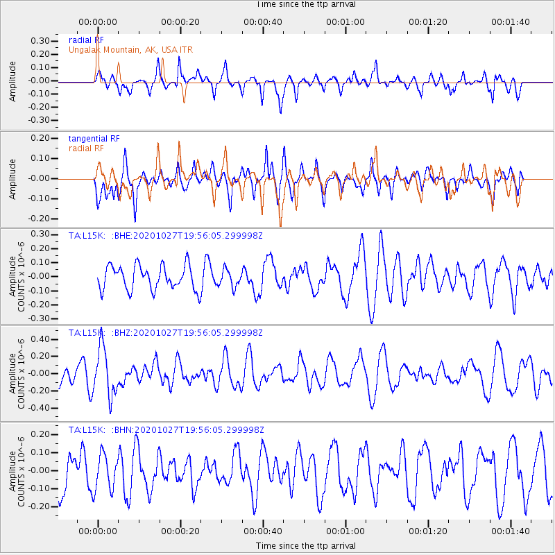
L15K Ungalak Mountain, AK, USA - Earthquake Result Viewer
*The percent match for this event was below the threshold and hence no stack was calculated.
| Earthquake location: |
Sulawesi, Indonesia |
| Earthquake latitude/longitude: |
-2.2/119.1 |
| Earthquake time(UTC): |
2020/10/27 (301) 19:43:52 GMT |
| Earthquake Depth: |
17 km |
| Earthquake Magnitude: |
5.5 Mww |
| Earthquake Catalog/Contributor: |
NEIC PDE/us |
|
| Network: |
TA USArray Transportable Network (new EarthScope stations) |
| Station: |
L15K Ungalak Mountain, AK, USA |
| Lat/Lon: |
61.68 N/161.49 W |
| Elevation: |
219 m |
|
| Distance: |
86.9 deg |
| Az: |
27.998 deg |
| Baz: |
259.617 deg |
| Ray Param: |
$rayparam |
*The percent match for this event was below the threshold and hence was not used in the summary stack. |
|
| Radial Match: |
53.921677 % |
| Radial Bump: |
400 |
| Transverse Match: |
40.846542 % |
| Transverse Bump: |
377 |
| SOD ConfigId: |
22732711 |
| Insert Time: |
2020-11-10 19:51:17.517 +0000 |
| GWidth: |
2.5 |
| Max Bumps: |
400 |
| Tol: |
0.001 |
|
Signal To Noise
| Channel | StoN | STA | LTA |
| TA:L15K: :BHZ:20201027T19:56:05.299998Z | 2.7183774 | 2.8415263E-7 | 1.0453024E-7 |
| TA:L15K: :BHN:20201027T19:56:05.299998Z | 0.97420067 | 9.61908E-8 | 9.873818E-8 |
| TA:L15K: :BHE:20201027T19:56:05.299998Z | 0.70303136 | 6.007859E-8 | 8.545649E-8 |
| Arrivals |
| Ps | |
| PpPs | |
| PsPs/PpSs | |


