You are here: Home > Network List > UW - Pacific Northwest Regional Seismic Network Stations List
> Station IRON Crane, OR, USA > Earthquake Result Viewer
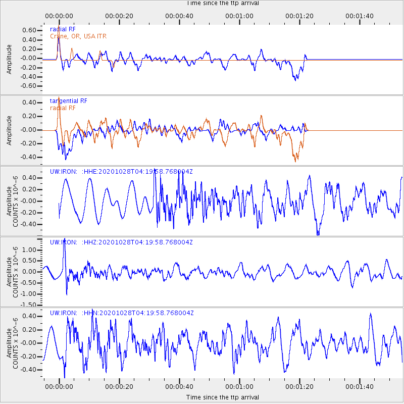
IRON Crane, OR, USA - Earthquake Result Viewer
*The percent match for this event was below the threshold and hence no stack was calculated.
| Earthquake location: |
Andreanof Islands, Aleutian Is. |
| Earthquake latitude/longitude: |
53.2/-173.4 |
| Earthquake time(UTC): |
2020/10/28 (302) 04:13:41 GMT |
| Earthquake Depth: |
233 km |
| Earthquake Magnitude: |
5.5 mww |
| Earthquake Catalog/Contributor: |
NEIC PDE/us |
|
| Network: |
UW Pacific Northwest Regional Seismic Network |
| Station: |
IRON Crane, OR, USA |
| Lat/Lon: |
43.36 N/118.47 W |
| Elevation: |
1226 m |
|
| Distance: |
37.0 deg |
| Az: |
82.661 deg |
| Baz: |
305.111 deg |
| Ray Param: |
$rayparam |
*The percent match for this event was below the threshold and hence was not used in the summary stack. |
|
| Radial Match: |
69.37483 % |
| Radial Bump: |
400 |
| Transverse Match: |
69.27503 % |
| Transverse Bump: |
400 |
| SOD ConfigId: |
22732711 |
| Insert Time: |
2020-11-11 04:38:04.977 +0000 |
| GWidth: |
2.5 |
| Max Bumps: |
400 |
| Tol: |
0.001 |
|
Signal To Noise
| Channel | StoN | STA | LTA |
| UW:IRON: :HHZ:20201028T04:19:58.768004Z | 2.752166 | 5.395477E-7 | 1.9604477E-7 |
| UW:IRON: :HHN:20201028T04:19:58.768004Z | 1.5588078 | 2.5668035E-7 | 1.6466451E-7 |
| UW:IRON: :HHE:20201028T04:19:58.768004Z | 1.0351124 | 2.4091037E-7 | 2.3273837E-7 |
| Arrivals |
| Ps | |
| PpPs | |
| PsPs/PpSs | |


