You are here: Home > Network List > WY - Yellowstone Wyoming Seismic Network Stations List
> Station YPP Pitchstone Plateau, YNP, WY, USA > Earthquake Result Viewer
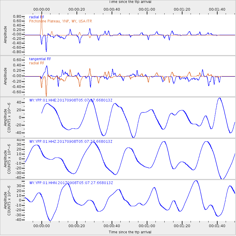
YPP Pitchstone Plateau, YNP, WY, USA - Earthquake Result Viewer
*The percent match for this event was below the threshold and hence no stack was calculated.
| Earthquake location: |
Near Coast Of Oaxaca, Mexico |
| Earthquake latitude/longitude: |
15.2/-94.3 |
| Earthquake time(UTC): |
2017/09/08 (251) 05:01:33 GMT |
| Earthquake Depth: |
36 km |
| Earthquake Magnitude: |
5.7 mb |
| Earthquake Catalog/Contributor: |
NEIC PDE/us |
|
| Network: |
WY Yellowstone Wyoming Seismic Network |
| Station: |
YPP Pitchstone Plateau, YNP, WY, USA |
| Lat/Lon: |
44.27 N/110.80 W |
| Elevation: |
2707 m |
|
| Distance: |
32.2 deg |
| Az: |
337.465 deg |
| Baz: |
148.993 deg |
| Ray Param: |
$rayparam |
*The percent match for this event was below the threshold and hence was not used in the summary stack. |
|
| Radial Match: |
89.84832 % |
| Radial Bump: |
400 |
| Transverse Match: |
51.4829 % |
| Transverse Bump: |
400 |
| SOD ConfigId: |
2307692 |
| Insert Time: |
2017-09-23 13:33:29.818 +0000 |
| GWidth: |
2.5 |
| Max Bumps: |
400 |
| Tol: |
0.001 |
|
Signal To Noise
| Channel | StoN | STA | LTA |
| WY:YPP:01:HHZ:20170908T05:07:27.668013Z | 0.68510634 | 1.2409557E-5 | 1.811333E-5 |
| WY:YPP:01:HHN:20170908T05:07:27.668013Z | 5.3393974 | 2.3762295E-5 | 4.4503704E-6 |
| WY:YPP:01:HHE:20170908T05:07:27.668013Z | 1.1560891 | 2.9674111E-5 | 2.566767E-5 |
| Arrivals |
| Ps | |
| PpPs | |
| PsPs/PpSs | |


