You are here: Home > Network List > WY - Yellowstone Wyoming Seismic Network Stations List
> Station YUF Upper Falls, WY, USA > Earthquake Result Viewer
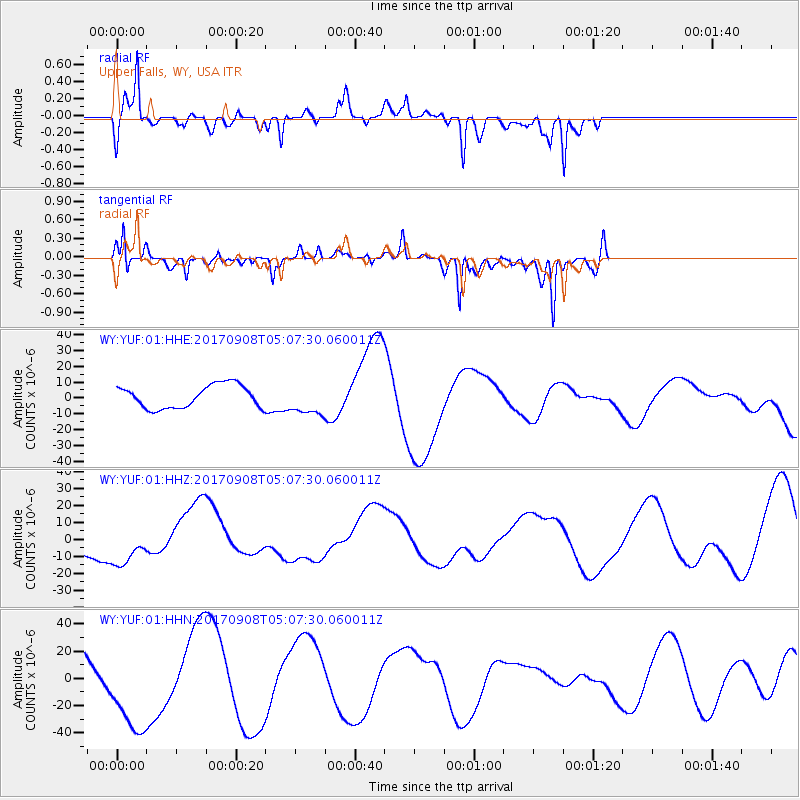
YUF Upper Falls, WY, USA - Earthquake Result Viewer
*The percent match for this event was below the threshold and hence no stack was calculated.
| Earthquake location: |
Near Coast Of Oaxaca, Mexico |
| Earthquake latitude/longitude: |
15.2/-94.3 |
| Earthquake time(UTC): |
2017/09/08 (251) 05:01:33 GMT |
| Earthquake Depth: |
36 km |
| Earthquake Magnitude: |
5.7 mb |
| Earthquake Catalog/Contributor: |
NEIC PDE/us |
|
| Network: |
WY Yellowstone Wyoming Seismic Network |
| Station: |
YUF Upper Falls, WY, USA |
| Lat/Lon: |
44.71 N/110.51 W |
| Elevation: |
2394 m |
|
| Distance: |
32.5 deg |
| Az: |
338.221 deg |
| Baz: |
149.837 deg |
| Ray Param: |
$rayparam |
*The percent match for this event was below the threshold and hence was not used in the summary stack. |
|
| Radial Match: |
81.19445 % |
| Radial Bump: |
400 |
| Transverse Match: |
81.455635 % |
| Transverse Bump: |
400 |
| SOD ConfigId: |
2307692 |
| Insert Time: |
2017-09-23 13:33:32.928 +0000 |
| GWidth: |
2.5 |
| Max Bumps: |
400 |
| Tol: |
0.001 |
|
Signal To Noise
| Channel | StoN | STA | LTA |
| WY:YUF:01:HHZ:20170908T05:07:30.060011Z | 1.4823966 | 1.3263801E-5 | 8.947539E-6 |
| WY:YUF:01:HHN:20170908T05:07:30.060011Z | 1.4185847 | 3.347084E-5 | 2.359453E-5 |
| WY:YUF:01:HHE:20170908T05:07:30.060011Z | 1.3442752 | 9.607211E-6 | 7.146759E-6 |
| Arrivals |
| Ps | |
| PpPs | |
| PsPs/PpSs | |


