You are here: Home > Network List > CN - Canadian National Seismograph Network Stations List
> Station INK INUVIK, NT > Earthquake Result Viewer
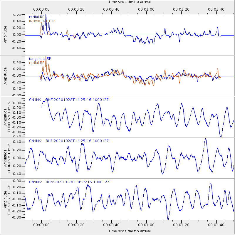
INK INUVIK, NT - Earthquake Result Viewer
*The percent match for this event was below the threshold and hence no stack was calculated.
| Earthquake location: |
Vanuatu Islands |
| Earthquake latitude/longitude: |
-14.4/167.4 |
| Earthquake time(UTC): |
2020/10/28 (302) 14:12:56 GMT |
| Earthquake Depth: |
178 km |
| Earthquake Magnitude: |
5.8 Mww |
| Earthquake Catalog/Contributor: |
NEIC PDE/us |
|
| Network: |
CN Canadian National Seismograph Network |
| Station: |
INK INUVIK, NT |
| Lat/Lon: |
68.31 N/133.53 W |
| Elevation: |
44 m |
|
| Distance: |
92.6 deg |
| Az: |
18.621 deg |
| Baz: |
236.31 deg |
| Ray Param: |
$rayparam |
*The percent match for this event was below the threshold and hence was not used in the summary stack. |
|
| Radial Match: |
55.586514 % |
| Radial Bump: |
400 |
| Transverse Match: |
36.65542 % |
| Transverse Bump: |
400 |
| SOD ConfigId: |
22732711 |
| Insert Time: |
2020-11-11 14:20:11.151 +0000 |
| GWidth: |
2.5 |
| Max Bumps: |
400 |
| Tol: |
0.001 |
|
Signal To Noise
| Channel | StoN | STA | LTA |
| CN:INK: :BHZ:20201028T14:25:16.100012Z | 0.87470096 | 1.12510406E-7 | 1.2862728E-7 |
| CN:INK: :BHN:20201028T14:25:16.100012Z | 1.1076597 | 1.0136634E-7 | 9.151397E-8 |
| CN:INK: :BHE:20201028T14:25:16.100012Z | 1.2082285 | 1.9609948E-7 | 1.6230331E-7 |
| Arrivals |
| Ps | |
| PpPs | |
| PsPs/PpSs | |


