You are here: Home > Network List > GS - US Geological Survey Networks Stations List
> Station DEC06 Boomer > Earthquake Result Viewer
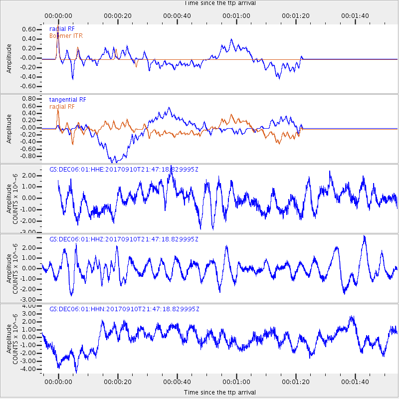
DEC06 Boomer - Earthquake Result Viewer
*The percent match for this event was below the threshold and hence no stack was calculated.
| Earthquake location: |
Reykjanes Ridge |
| Earthquake latitude/longitude: |
57.1/-33.7 |
| Earthquake time(UTC): |
2017/09/10 (253) 21:40:21 GMT |
| Earthquake Depth: |
10 km |
| Earthquake Magnitude: |
5.9 Mww |
| Earthquake Catalog/Contributor: |
NEIC PDE/us |
|
| Network: |
GS US Geological Survey Networks |
| Station: |
DEC06 Boomer |
| Lat/Lon: |
39.90 N/88.95 W |
| Elevation: |
215 m |
|
| Distance: |
39.2 deg |
| Az: |
268.281 deg |
| Baz: |
45.118 deg |
| Ray Param: |
$rayparam |
*The percent match for this event was below the threshold and hence was not used in the summary stack. |
|
| Radial Match: |
52.28138 % |
| Radial Bump: |
400 |
| Transverse Match: |
37.17402 % |
| Transverse Bump: |
400 |
| SOD ConfigId: |
2307692 |
| Insert Time: |
2017-09-24 21:44:15.191 +0000 |
| GWidth: |
2.5 |
| Max Bumps: |
400 |
| Tol: |
0.001 |
|
Signal To Noise
| Channel | StoN | STA | LTA |
| GS:DEC06:01:HHZ:20170910T21:47:18.829995Z | 2.729476 | 1.3567457E-6 | 4.970718E-7 |
| GS:DEC06:01:HHN:20170910T21:47:18.829995Z | 5.0420094 | 3.8695935E-6 | 7.6747045E-7 |
| GS:DEC06:01:HHE:20170910T21:47:18.829995Z | 1.738233 | 1.4264036E-6 | 8.206056E-7 |
| Arrivals |
| Ps | |
| PpPs | |
| PsPs/PpSs | |


