You are here: Home > Network List > IW - Intermountain West Stations List
> Station MOOW Moose Ponds, Wyoming, USA > Earthquake Result Viewer
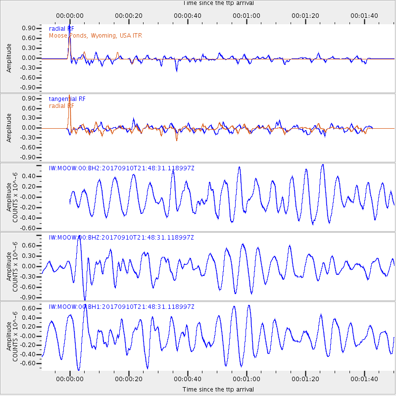
MOOW Moose Ponds, Wyoming, USA - Earthquake Result Viewer
*The percent match for this event was below the threshold and hence no stack was calculated.
| Earthquake location: |
Reykjanes Ridge |
| Earthquake latitude/longitude: |
57.1/-33.7 |
| Earthquake time(UTC): |
2017/09/10 (253) 21:40:21 GMT |
| Earthquake Depth: |
10 km |
| Earthquake Magnitude: |
5.9 Mww |
| Earthquake Catalog/Contributor: |
NEIC PDE/us |
|
| Network: |
IW Intermountain West |
| Station: |
MOOW Moose Ponds, Wyoming, USA |
| Lat/Lon: |
43.75 N/110.74 W |
| Elevation: |
2128 m |
|
| Distance: |
48.2 deg |
| Az: |
288.756 deg |
| Baz: |
45.444 deg |
| Ray Param: |
$rayparam |
*The percent match for this event was below the threshold and hence was not used in the summary stack. |
|
| Radial Match: |
69.92934 % |
| Radial Bump: |
393 |
| Transverse Match: |
70.04841 % |
| Transverse Bump: |
380 |
| SOD ConfigId: |
2307692 |
| Insert Time: |
2017-09-24 21:45:57.985 +0000 |
| GWidth: |
2.5 |
| Max Bumps: |
400 |
| Tol: |
0.001 |
|
Signal To Noise
| Channel | StoN | STA | LTA |
| IW:MOOW:00:BHZ:20170910T21:48:31.118997Z | 3.1196904 | 4.8137184E-7 | 1.5430115E-7 |
| IW:MOOW:00:BH1:20170910T21:48:31.118997Z | 2.266508 | 4.4941032E-7 | 1.9828313E-7 |
| IW:MOOW:00:BH2:20170910T21:48:31.118997Z | 0.91582835 | 2.149162E-7 | 2.3466865E-7 |
| Arrivals |
| Ps | |
| PpPs | |
| PsPs/PpSs | |


