PANJ Princeton, NJ - Earthquake Result Viewer
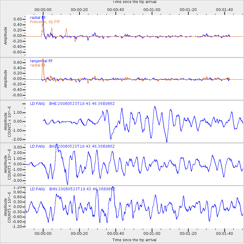
Earthquake location: Central Mid-Atlantic Ridge
Earthquake latitude/longitude: 7.3/-34.9
Earthquake time(UTC): 2008/05/23 (144) 19:35:34 GMT
Earthquake Depth: 9.0 km
Earthquake Magnitude: 6.0 MB, 6.4 MS, 6.5 MW, 6.5 MW
Earthquake Catalog/Contributor: WHDF/NEIC
Network: LD Lamont-Doherty Cooperative Seismographic Network
Station: PANJ Princeton, NJ
Lat/Lon: 40.38 N/74.70 W
Elevation: 100 m
Distance: 48.4 deg
Az: 319.165 deg
Baz: 121.891 deg
Ray Param: 0.069381826
Estimated Moho Depth: 35.5 km
Estimated Crust Vp/Vs: 1.70
Assumed Crust Vp: 6.283 km/s
Estimated Crust Vs: 3.707 km/s
Estimated Crust Poisson's Ratio: 0.23
Radial Match: 94.31382 %
Radial Bump: 300
Transverse Match: 77.1234 %
Transverse Bump: 400
SOD ConfigId: 2504
Insert Time: 2010-03-09 03:07:06.849 +0000
GWidth: 2.5
Max Bumps: 400
Tol: 0.001

Signal To Noise

ChannelStoNSTALTA
LD:PANJ: :BHZ:20080523T19:43:46.368986Z5.90558051.1420857E-61.9339093E-7
LD:PANJ: :BHN:20080523T19:43:46.368986Z2.37342244.113886E-71.733314E-7
LD:PANJ: :BHE:20080523T19:43:46.368986Z3.5893125.763812E-71.6058263E-7
Arrivals
Ps4.2 SECOND
PpPs14 SECOND
PsPs/PpSs19 SECOND