You are here: Home > Network List > US - United States National Seismic Network Stations List
> Station DUG Dugway, Tooele County, Utah, USA > Earthquake Result Viewer
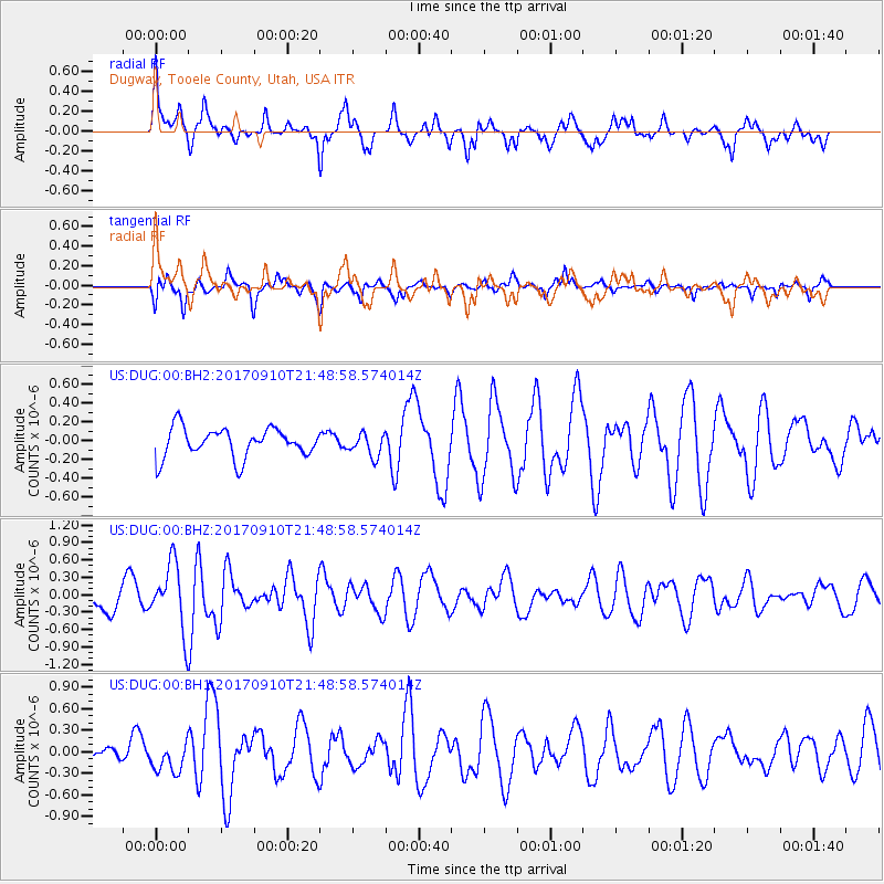
DUG Dugway, Tooele County, Utah, USA - Earthquake Result Viewer
*The percent match for this event was below the threshold and hence no stack was calculated.
| Earthquake location: |
Reykjanes Ridge |
| Earthquake latitude/longitude: |
57.1/-33.7 |
| Earthquake time(UTC): |
2017/09/10 (253) 21:40:21 GMT |
| Earthquake Depth: |
10 km |
| Earthquake Magnitude: |
5.9 Mww |
| Earthquake Catalog/Contributor: |
NEIC PDE/us |
|
| Network: |
US United States National Seismic Network |
| Station: |
DUG Dugway, Tooele County, Utah, USA |
| Lat/Lon: |
40.19 N/112.81 W |
| Elevation: |
1477 m |
|
| Distance: |
51.9 deg |
| Az: |
286.971 deg |
| Baz: |
42.918 deg |
| Ray Param: |
$rayparam |
*The percent match for this event was below the threshold and hence was not used in the summary stack. |
|
| Radial Match: |
65.76182 % |
| Radial Bump: |
343 |
| Transverse Match: |
60.88854 % |
| Transverse Bump: |
353 |
| SOD ConfigId: |
2307692 |
| Insert Time: |
2017-09-24 21:46:49.278 +0000 |
| GWidth: |
2.5 |
| Max Bumps: |
400 |
| Tol: |
0.001 |
|
Signal To Noise
| Channel | StoN | STA | LTA |
| US:DUG:00:BHZ:20170910T21:48:58.574014Z | 3.1076863 | 5.6532696E-7 | 1.819125E-7 |
| US:DUG:00:BH1:20170910T21:48:58.574014Z | 1.2515666 | 2.1698747E-7 | 1.733727E-7 |
| US:DUG:00:BH2:20170910T21:48:58.574014Z | 0.77275187 | 1.2009988E-7 | 1.5541845E-7 |
| Arrivals |
| Ps | |
| PpPs | |
| PsPs/PpSs | |


