You are here: Home > Network List > US - United States National Seismic Network Stations List
> Station DGMT Dagmar, Montana, USA > Earthquake Result Viewer
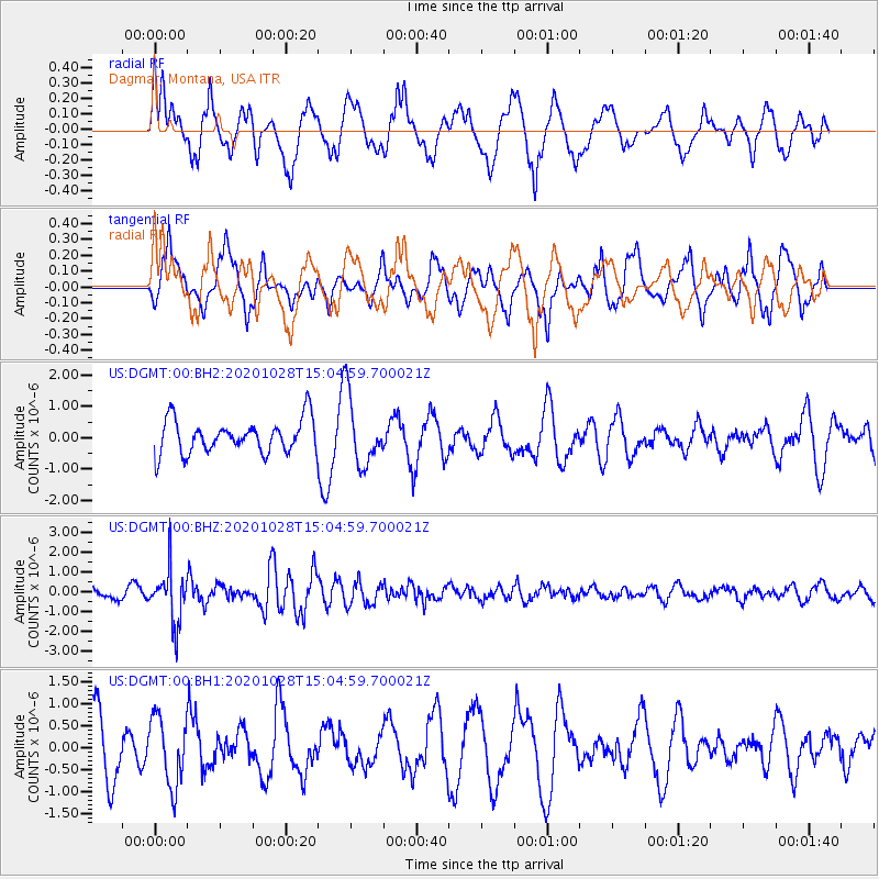
DGMT Dagmar, Montana, USA - Earthquake Result Viewer
*The percent match for this event was below the threshold and hence no stack was calculated.
| Earthquake location: |
Near Coast Of Central Chile |
| Earthquake latitude/longitude: |
-29.3/-71.2 |
| Earthquake time(UTC): |
2020/10/28 (302) 14:53:10 GMT |
| Earthquake Depth: |
44 km |
| Earthquake Magnitude: |
5.8 Mww |
| Earthquake Catalog/Contributor: |
NEIC PDE/us |
|
| Network: |
US United States National Seismic Network |
| Station: |
DGMT Dagmar, Montana, USA |
| Lat/Lon: |
48.47 N/104.20 W |
| Elevation: |
0.0 m |
|
| Distance: |
82.9 deg |
| Az: |
338.587 deg |
| Baz: |
151.378 deg |
| Ray Param: |
$rayparam |
*The percent match for this event was below the threshold and hence was not used in the summary stack. |
|
| Radial Match: |
60.566895 % |
| Radial Bump: |
400 |
| Transverse Match: |
65.758385 % |
| Transverse Bump: |
390 |
| SOD ConfigId: |
22732711 |
| Insert Time: |
2020-11-11 15:13:19.750 +0000 |
| GWidth: |
2.5 |
| Max Bumps: |
400 |
| Tol: |
0.001 |
|
Signal To Noise
| Channel | StoN | STA | LTA |
| US:DGMT:00:BHZ:20201028T15:04:59.700021Z | 5.911506 | 1.3495472E-6 | 2.2829161E-7 |
| US:DGMT:00:BH1:20201028T15:04:59.700021Z | 1.0793316 | 7.741804E-7 | 7.172776E-7 |
| US:DGMT:00:BH2:20201028T15:04:59.700021Z | 2.0344915 | 1.0716586E-6 | 5.267452E-7 |
| Arrivals |
| Ps | |
| PpPs | |
| PsPs/PpSs | |


