You are here: Home > Network List > US - United States National Seismic Network Stations List
> Station MNTX Cornudas Mountains, Texas, USA > Earthquake Result Viewer
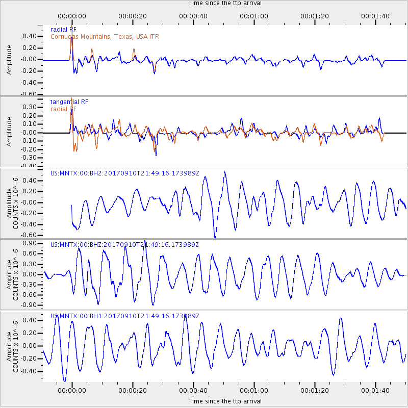
MNTX Cornudas Mountains, Texas, USA - Earthquake Result Viewer
*The percent match for this event was below the threshold and hence no stack was calculated.
| Earthquake location: |
Reykjanes Ridge |
| Earthquake latitude/longitude: |
57.1/-33.7 |
| Earthquake time(UTC): |
2017/09/10 (253) 21:40:21 GMT |
| Earthquake Depth: |
10 km |
| Earthquake Magnitude: |
5.9 Mww |
| Earthquake Catalog/Contributor: |
NEIC PDE/us |
|
| Network: |
US United States National Seismic Network |
| Station: |
MNTX Cornudas Mountains, Texas, USA |
| Lat/Lon: |
31.70 N/105.38 W |
| Elevation: |
404 m |
|
| Distance: |
54.3 deg |
| Az: |
274.302 deg |
| Baz: |
39.641 deg |
| Ray Param: |
$rayparam |
*The percent match for this event was below the threshold and hence was not used in the summary stack. |
|
| Radial Match: |
62.47658 % |
| Radial Bump: |
400 |
| Transverse Match: |
53.65129 % |
| Transverse Bump: |
389 |
| SOD ConfigId: |
2307692 |
| Insert Time: |
2017-09-24 21:47:08.975 +0000 |
| GWidth: |
2.5 |
| Max Bumps: |
400 |
| Tol: |
0.001 |
|
Signal To Noise
| Channel | StoN | STA | LTA |
| US:MNTX:00:BHZ:20170910T21:49:16.173989Z | 4.924294 | 4.5483048E-7 | 9.23646E-8 |
| US:MNTX:00:BH1:20170910T21:49:16.173989Z | 1.6751229 | 2.705222E-7 | 1.6149396E-7 |
| US:MNTX:00:BH2:20170910T21:49:16.173989Z | 0.7970146 | 1.5096603E-7 | 1.894144E-7 |
| Arrivals |
| Ps | |
| PpPs | |
| PsPs/PpSs | |


