You are here: Home > Network List > GS - US Geological Survey Networks Stations List
> Station OK051 E0350 and S34600 Roads, Ralston, OK > Earthquake Result Viewer
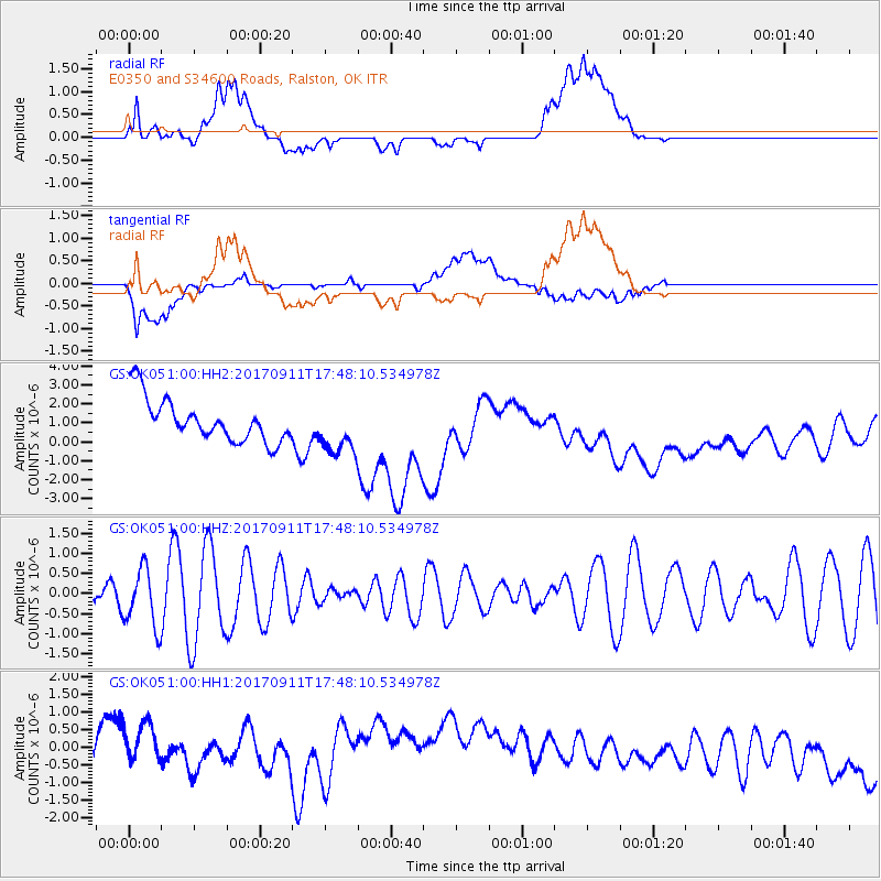
OK051 E0350 and S34600 Roads, Ralston, OK - Earthquake Result Viewer
*The percent match for this event was below the threshold and hence no stack was calculated.
| Earthquake location: |
Volcano Islands, Japan Region |
| Earthquake latitude/longitude: |
24.0/142.3 |
| Earthquake time(UTC): |
2017/09/11 (254) 17:35:09 GMT |
| Earthquake Depth: |
35 km |
| Earthquake Magnitude: |
5.7 Mww |
| Earthquake Catalog/Contributor: |
NEIC PDE/us |
|
| Network: |
GS US Geological Survey Networks |
| Station: |
OK051 E0350 and S34600 Roads, Ralston, OK |
| Lat/Lon: |
36.51 N/96.84 W |
| Elevation: |
263 m |
|
| Distance: |
98.0 deg |
| Az: |
44.317 deg |
| Baz: |
307.506 deg |
| Ray Param: |
$rayparam |
*The percent match for this event was below the threshold and hence was not used in the summary stack. |
|
| Radial Match: |
47.082726 % |
| Radial Bump: |
400 |
| Transverse Match: |
47.555275 % |
| Transverse Bump: |
400 |
| SOD ConfigId: |
2307692 |
| Insert Time: |
2017-09-25 17:40:19.197 +0000 |
| GWidth: |
2.5 |
| Max Bumps: |
400 |
| Tol: |
0.001 |
|
Signal To Noise
| Channel | StoN | STA | LTA |
| GS:OK051:00:HHZ:20170911T17:48:10.534978Z | 1.5498929 | 7.1279845E-7 | 4.5990174E-7 |
| GS:OK051:00:HH1:20170911T17:48:10.534978Z | 0.91465914 | 1.2043852E-6 | 1.3167585E-6 |
| GS:OK051:00:HH2:20170911T17:48:10.534978Z | 1.1859002 | 1.3491995E-6 | 1.1377006E-6 |
| Arrivals |
| Ps | |
| PpPs | |
| PsPs/PpSs | |


