You are here: Home > Network List > US - United States National Seismic Network Stations List
> Station DGMT Dagmar, Montana, USA > Earthquake Result Viewer
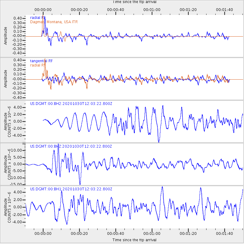
DGMT Dagmar, Montana, USA - Earthquake Result Viewer
*The percent match for this event was below the threshold and hence no stack was calculated.
| Earthquake location: |
Dodecanese Islands, Greece |
| Earthquake latitude/longitude: |
37.9/26.8 |
| Earthquake time(UTC): |
2020/10/30 (304) 11:51:27 GMT |
| Earthquake Depth: |
21 km |
| Earthquake Magnitude: |
7.0 mww |
| Earthquake Catalog/Contributor: |
NEIC PDE/us |
|
| Network: |
US United States National Seismic Network |
| Station: |
DGMT Dagmar, Montana, USA |
| Lat/Lon: |
48.47 N/104.20 W |
| Elevation: |
0.0 m |
|
| Distance: |
83.6 deg |
| Az: |
329.634 deg |
| Baz: |
36.926 deg |
| Ray Param: |
$rayparam |
*The percent match for this event was below the threshold and hence was not used in the summary stack. |
|
| Radial Match: |
72.32296 % |
| Radial Bump: |
273 |
| Transverse Match: |
41.63642 % |
| Transverse Bump: |
306 |
| SOD ConfigId: |
23341671 |
| Insert Time: |
2020-11-13 13:18:10.087 +0000 |
| GWidth: |
2.5 |
| Max Bumps: |
400 |
| Tol: |
0.001 |
|
Signal To Noise
| Channel | StoN | STA | LTA |
| US:DGMT:00:BHZ:20201030T12:03:22.800Z | 3.8232749 | 2.671412E-6 | 6.9872345E-7 |
| US:DGMT:00:BH1:20201030T12:03:22.800Z | 1.1042926 | 9.89304E-7 | 8.958712E-7 |
| US:DGMT:00:BH2:20201030T12:03:22.800Z | 1.4736532 | 1.896221E-6 | 1.2867484E-6 |
| Arrivals |
| Ps | |
| PpPs | |
| PsPs/PpSs | |


