You are here: Home > Network List > US - United States National Seismic Network Stations List
> Station WMOK Wichita Mountains, Oklahoma, USA > Earthquake Result Viewer
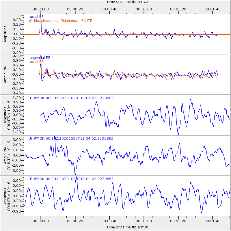
WMOK Wichita Mountains, Oklahoma, USA - Earthquake Result Viewer
*The percent match for this event was below the threshold and hence no stack was calculated.
| Earthquake location: |
Dodecanese Islands, Greece |
| Earthquake latitude/longitude: |
37.9/26.8 |
| Earthquake time(UTC): |
2020/10/30 (304) 11:51:27 GMT |
| Earthquake Depth: |
21 km |
| Earthquake Magnitude: |
7.0 mww |
| Earthquake Catalog/Contributor: |
NEIC PDE/us |
|
| Network: |
US United States National Seismic Network |
| Station: |
WMOK Wichita Mountains, Oklahoma, USA |
| Lat/Lon: |
34.74 N/98.78 W |
| Elevation: |
486 m |
|
| Distance: |
91.8 deg |
| Az: |
317.917 deg |
| Baz: |
40.063 deg |
| Ray Param: |
$rayparam |
*The percent match for this event was below the threshold and hence was not used in the summary stack. |
|
| Radial Match: |
73.263336 % |
| Radial Bump: |
400 |
| Transverse Match: |
53.450596 % |
| Transverse Bump: |
400 |
| SOD ConfigId: |
23341671 |
| Insert Time: |
2020-11-13 13:18:52.416 +0000 |
| GWidth: |
2.5 |
| Max Bumps: |
400 |
| Tol: |
0.001 |
|
Signal To Noise
| Channel | StoN | STA | LTA |
| US:WMOK:00:BHZ:20201030T12:04:02.323986Z | 3.0408802 | 9.703108E-7 | 3.190888E-7 |
| US:WMOK:00:BH1:20201030T12:04:02.323986Z | 1.066846 | 3.6886595E-7 | 3.4575368E-7 |
| US:WMOK:00:BH2:20201030T12:04:02.323986Z | 1.9044963 | 5.088013E-7 | 2.6715793E-7 |
| Arrivals |
| Ps | |
| PpPs | |
| PsPs/PpSs | |


