You are here: Home > Network List > GM - US Geological Survey Networks Stations List
> Station IWM01 Jericho 2M Well Monitoring Station > Earthquake Result Viewer
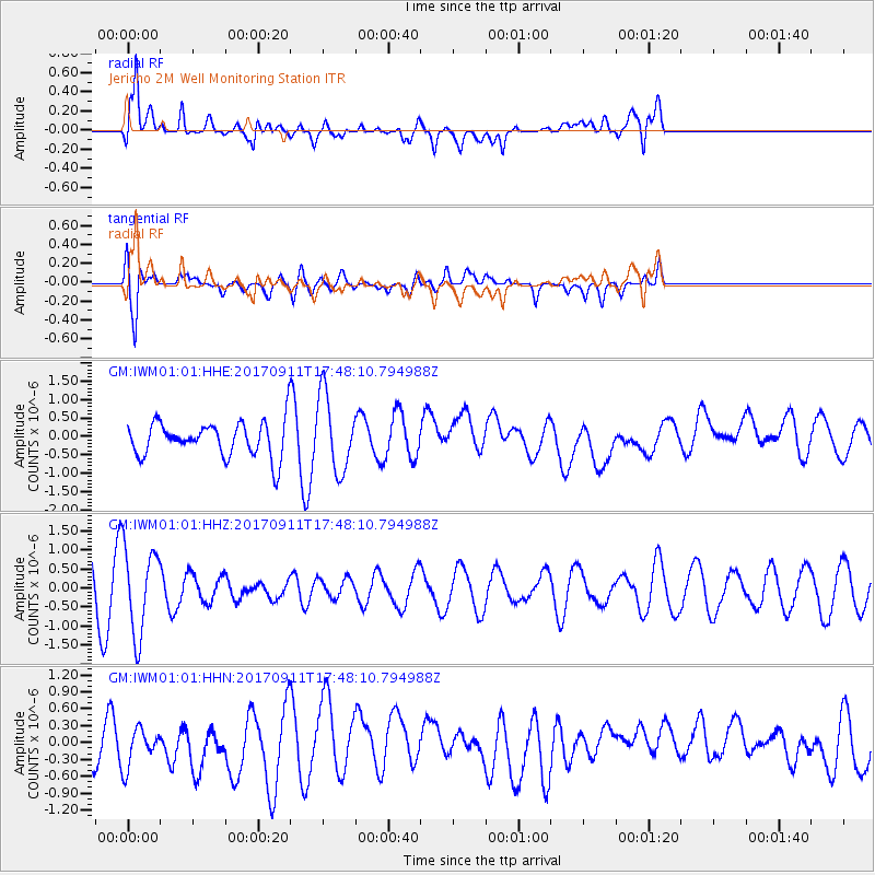
IWM01 Jericho 2M Well Monitoring Station - Earthquake Result Viewer
*The percent match for this event was below the threshold and hence no stack was calculated.
| Earthquake location: |
Volcano Islands, Japan Region |
| Earthquake latitude/longitude: |
24.0/142.3 |
| Earthquake time(UTC): |
2017/09/11 (254) 17:35:09 GMT |
| Earthquake Depth: |
35 km |
| Earthquake Magnitude: |
5.7 Mww |
| Earthquake Catalog/Contributor: |
NEIC PDE/us |
|
| Network: |
GM US Geological Survey Networks |
| Station: |
IWM01 Jericho 2M Well Monitoring Station |
| Lat/Lon: |
36.73 N/96.53 W |
| Elevation: |
328 m |
|
| Distance: |
98.0 deg |
| Az: |
43.989 deg |
| Baz: |
307.732 deg |
| Ray Param: |
$rayparam |
*The percent match for this event was below the threshold and hence was not used in the summary stack. |
|
| Radial Match: |
68.33422 % |
| Radial Bump: |
400 |
| Transverse Match: |
66.30733 % |
| Transverse Bump: |
400 |
| SOD ConfigId: |
2307692 |
| Insert Time: |
2017-09-25 17:44:42.393 +0000 |
| GWidth: |
2.5 |
| Max Bumps: |
400 |
| Tol: |
0.001 |
|
Signal To Noise
| Channel | StoN | STA | LTA |
| GM:IWM01:01:HHZ:20170911T17:48:10.794988Z | 2.5648925 | 1.1475939E-6 | 4.4742382E-7 |
| GM:IWM01:01:HHN:20170911T17:48:10.794988Z | 1.0479383 | 3.8808142E-7 | 3.703285E-7 |
| GM:IWM01:01:HHE:20170911T17:48:10.794988Z | 2.213514 | 1.034736E-6 | 4.6746302E-7 |
| Arrivals |
| Ps | |
| PpPs | |
| PsPs/PpSs | |


