You are here: Home > Network List > IU - Global Seismograph Network (GSN - IRIS/USGS) Stations List
> Station RSSD Black Hills, South Dakota, USA > Earthquake Result Viewer
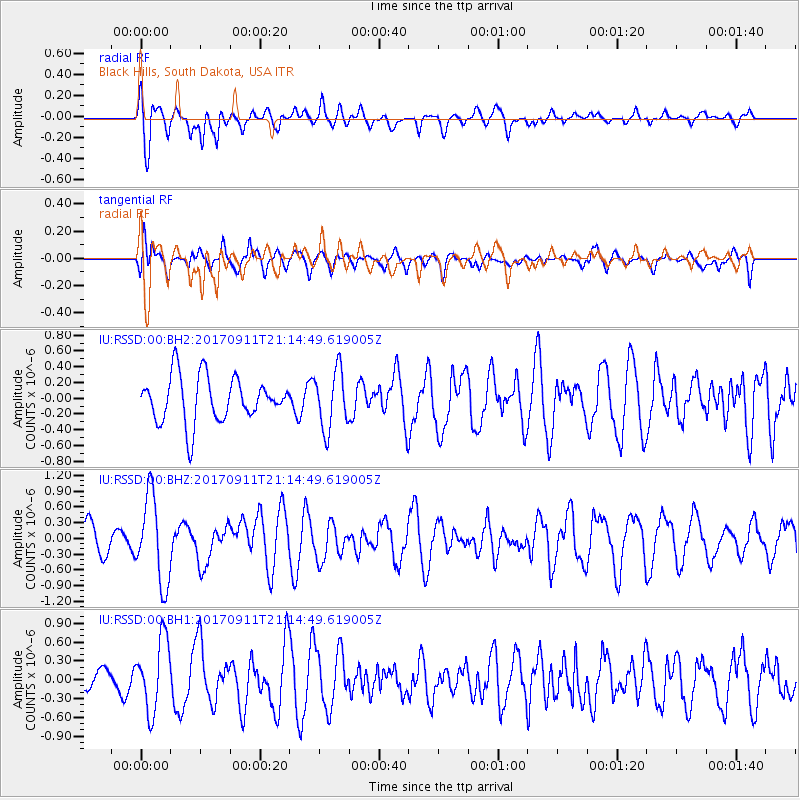
RSSD Black Hills, South Dakota, USA - Earthquake Result Viewer
*The percent match for this event was below the threshold and hence no stack was calculated.
| Earthquake location: |
Near Coast Of Chiapas, Mexico |
| Earthquake latitude/longitude: |
14.9/-93.9 |
| Earthquake time(UTC): |
2017/09/11 (254) 21:09:10 GMT |
| Earthquake Depth: |
27 km |
| Earthquake Magnitude: |
5.5 Mww |
| Earthquake Catalog/Contributor: |
NEIC PDE/us |
|
| Network: |
IU Global Seismograph Network (GSN - IRIS/USGS) |
| Station: |
RSSD Black Hills, South Dakota, USA |
| Lat/Lon: |
44.12 N/104.04 W |
| Elevation: |
2090 m |
|
| Distance: |
30.4 deg |
| Az: |
345.556 deg |
| Baz: |
160.434 deg |
| Ray Param: |
$rayparam |
*The percent match for this event was below the threshold and hence was not used in the summary stack. |
|
| Radial Match: |
61.076523 % |
| Radial Bump: |
400 |
| Transverse Match: |
55.506634 % |
| Transverse Bump: |
400 |
| SOD ConfigId: |
2307692 |
| Insert Time: |
2017-09-25 21:11:51.205 +0000 |
| GWidth: |
2.5 |
| Max Bumps: |
400 |
| Tol: |
0.001 |
|
Signal To Noise
| Channel | StoN | STA | LTA |
| IU:RSSD:00:BHZ:20170911T21:14:49.619005Z | 2.4584563 | 8.298177E-7 | 3.3753608E-7 |
| IU:RSSD:00:BH1:20170911T21:14:49.619005Z | 2.9765115 | 5.7040427E-7 | 1.9163517E-7 |
| IU:RSSD:00:BH2:20170911T21:14:49.619005Z | 1.2977451 | 3.7223424E-7 | 2.8683155E-7 |
| Arrivals |
| Ps | |
| PpPs | |
| PsPs/PpSs | |


