You are here: Home > Network List > US - United States National Seismic Network Stations List
> Station EGMT Eagleton, Montana, USA > Earthquake Result Viewer
EGMT Eagleton, Montana, USA - Earthquake Result Viewer
*The percent match for this event was below the threshold and hence no stack was calculated.
| Earthquake location: |
Near Coast Of Chiapas, Mexico |
| Earthquake latitude/longitude: |
14.9/-93.9 |
| Earthquake time(UTC): |
2017/09/11 (254) 21:09:10 GMT |
| Earthquake Depth: |
27 km |
| Earthquake Magnitude: |
5.5 Mww |
| Earthquake Catalog/Contributor: |
NEIC PDE/us |
|
| Network: |
US United States National Seismic Network |
| Station: |
EGMT Eagleton, Montana, USA |
| Lat/Lon: |
48.02 N/109.75 W |
| Elevation: |
1055 m |
|
| Distance: |
35.6 deg |
| Az: |
341.666 deg |
| Baz: |
153.058 deg |
| Ray Param: |
$rayparam |
*The percent match for this event was below the threshold and hence was not used in the summary stack. |
|
| Radial Match: |
52.458405 % |
| Radial Bump: |
296 |
| Transverse Match: |
44.89187 % |
| Transverse Bump: |
400 |
| SOD ConfigId: |
2307692 |
| Insert Time: |
2017-09-25 21:12:51.591 +0000 |
| GWidth: |
2.5 |
| Max Bumps: |
400 |
| Tol: |
0.001 |
|
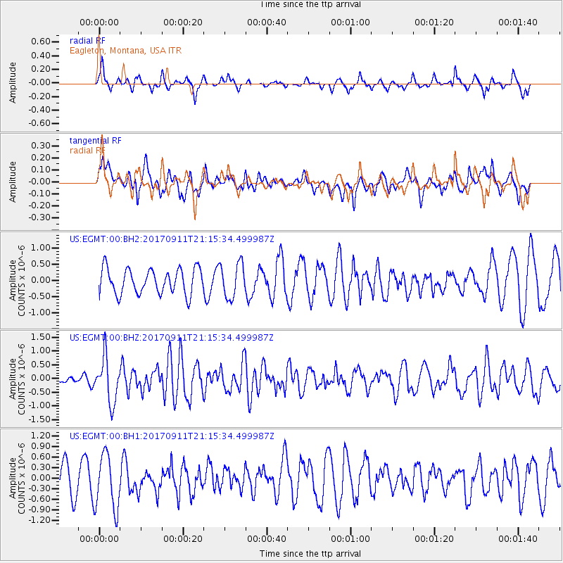
Signal To Noise
| Channel | StoN | STA | LTA |
| US:EGMT:00:BHZ:20170911T21:15:34.499987Z | 3.629439 | 8.2909975E-7 | 2.2843743E-7 |
| US:EGMT:00:BH1:20170911T21:15:34.499987Z | 2.201582 | 7.891393E-7 | 3.5844192E-7 |
| US:EGMT:00:BH2:20170911T21:15:34.499987Z | 1.3667313 | 5.2982335E-7 | 3.8765728E-7 |
| Arrivals |
| Ps | |
| PpPs | |
| PsPs/PpSs | |


