You are here: Home > Network List > TA - USArray Transportable Network (new EarthScope stations) Stations List
> Station H31M Peel River, Yukon, CAN > Earthquake Result Viewer
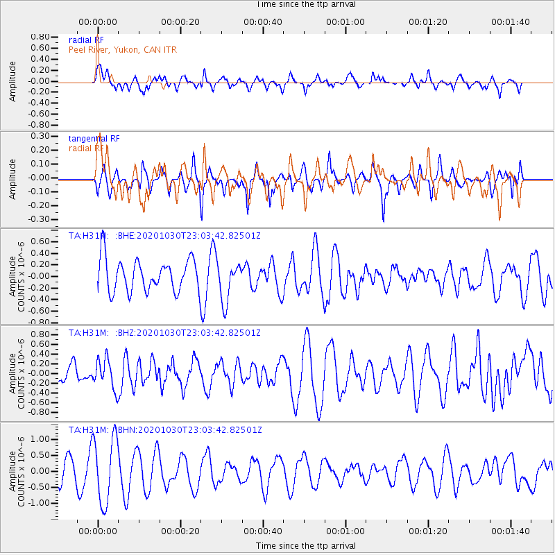
H31M Peel River, Yukon, CAN - Earthquake Result Viewer
*The percent match for this event was below the threshold and hence no stack was calculated.
| Earthquake location: |
Jan Mayen Island Region |
| Earthquake latitude/longitude: |
71.6/-3.3 |
| Earthquake time(UTC): |
2020/10/30 (304) 22:56:47 GMT |
| Earthquake Depth: |
10 km |
| Earthquake Magnitude: |
5.6 mww |
| Earthquake Catalog/Contributor: |
NEIC PDE/us |
|
| Network: |
TA USArray Transportable Network (new EarthScope stations) |
| Station: |
H31M Peel River, Yukon, CAN |
| Lat/Lon: |
65.81 N/134.34 W |
| Elevation: |
642 m |
|
| Distance: |
38.9 deg |
| Az: |
330.342 deg |
| Baz: |
22.459 deg |
| Ray Param: |
$rayparam |
*The percent match for this event was below the threshold and hence was not used in the summary stack. |
|
| Radial Match: |
37.55479 % |
| Radial Bump: |
325 |
| Transverse Match: |
51.31664 % |
| Transverse Bump: |
292 |
| SOD ConfigId: |
23341671 |
| Insert Time: |
2020-11-14 00:13:52.321 +0000 |
| GWidth: |
2.5 |
| Max Bumps: |
400 |
| Tol: |
0.001 |
|
Signal To Noise
| Channel | StoN | STA | LTA |
| TA:H31M: :BHZ:20201030T23:03:42.82501Z | 0.94815373 | 3.1370217E-7 | 3.308558E-7 |
| TA:H31M: :BHN:20201030T23:03:42.82501Z | 2.3662775 | 1.0339146E-6 | 4.3693717E-7 |
| TA:H31M: :BHE:20201030T23:03:42.82501Z | 1.2435074 | 3.4521807E-7 | 2.7761644E-7 |
| Arrivals |
| Ps | |
| PpPs | |
| PsPs/PpSs | |


