You are here: Home > Network List > US - United States National Seismic Network Stations List
> Station LKWY Lake (Yellowstone--Lake), Wyoming, USA > Earthquake Result Viewer
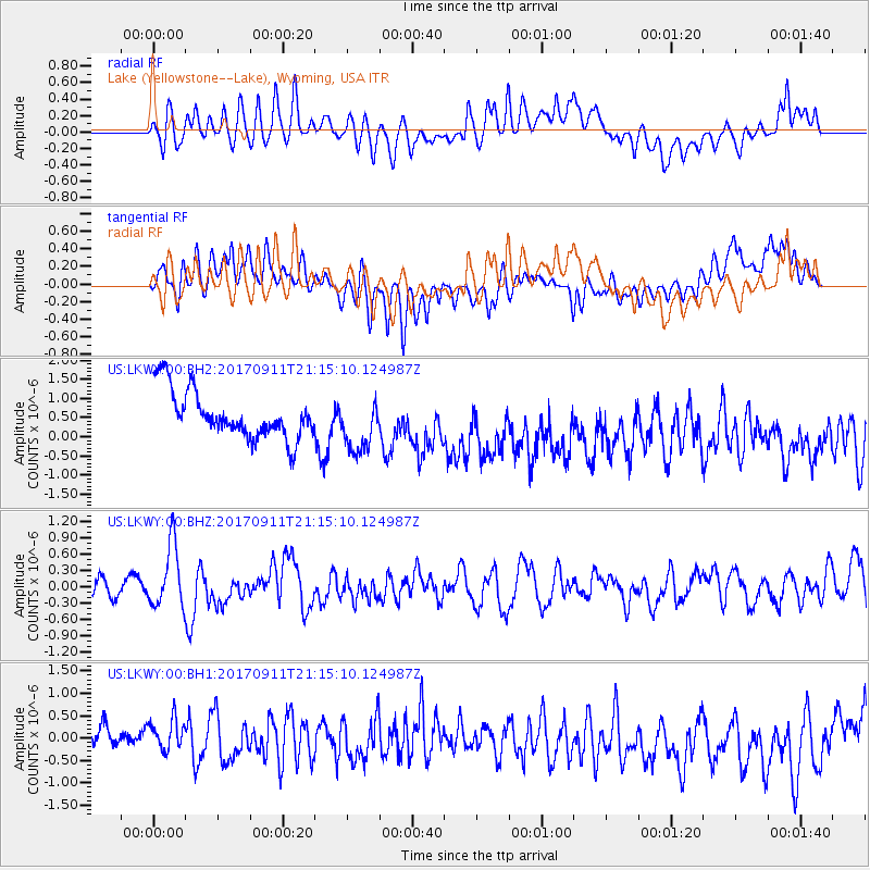
LKWY Lake (Yellowstone--Lake), Wyoming, USA - Earthquake Result Viewer
*The percent match for this event was below the threshold and hence no stack was calculated.
| Earthquake location: |
Near Coast Of Chiapas, Mexico |
| Earthquake latitude/longitude: |
14.9/-93.9 |
| Earthquake time(UTC): |
2017/09/11 (254) 21:09:10 GMT |
| Earthquake Depth: |
27 km |
| Earthquake Magnitude: |
5.5 Mww |
| Earthquake Catalog/Contributor: |
NEIC PDE/us |
|
| Network: |
US United States National Seismic Network |
| Station: |
LKWY Lake (Yellowstone--Lake), Wyoming, USA |
| Lat/Lon: |
44.57 N/110.40 W |
| Elevation: |
2424 m |
|
| Distance: |
32.7 deg |
| Az: |
338.009 deg |
| Baz: |
149.564 deg |
| Ray Param: |
$rayparam |
*The percent match for this event was below the threshold and hence was not used in the summary stack. |
|
| Radial Match: |
48.71989 % |
| Radial Bump: |
400 |
| Transverse Match: |
30.839985 % |
| Transverse Bump: |
400 |
| SOD ConfigId: |
2307692 |
| Insert Time: |
2017-09-25 21:13:02.052 +0000 |
| GWidth: |
2.5 |
| Max Bumps: |
400 |
| Tol: |
0.001 |
|
Signal To Noise
| Channel | StoN | STA | LTA |
| US:LKWY:00:BHZ:20170911T21:15:10.124987Z | 4.1852064 | 5.7688595E-7 | 1.3783931E-7 |
| US:LKWY:00:BH1:20170911T21:15:10.124987Z | 1.2711514 | 3.562209E-7 | 2.8023481E-7 |
| US:LKWY:00:BH2:20170911T21:15:10.124987Z | 1.1492811 | 7.1364724E-7 | 6.209509E-7 |
| Arrivals |
| Ps | |
| PpPs | |
| PsPs/PpSs | |


