You are here: Home > Network List > US - United States National Seismic Network Stations List
> Station LONY Lake Ozonia, New York, USA > Earthquake Result Viewer
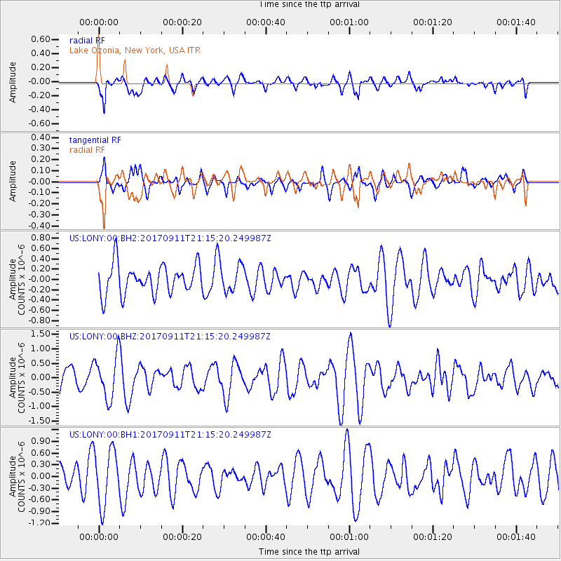
LONY Lake Ozonia, New York, USA - Earthquake Result Viewer
*The percent match for this event was below the threshold and hence no stack was calculated.
| Earthquake location: |
Near Coast Of Chiapas, Mexico |
| Earthquake latitude/longitude: |
14.9/-93.9 |
| Earthquake time(UTC): |
2017/09/11 (254) 21:09:10 GMT |
| Earthquake Depth: |
27 km |
| Earthquake Magnitude: |
5.5 Mww |
| Earthquake Catalog/Contributor: |
NEIC PDE/us |
|
| Network: |
US United States National Seismic Network |
| Station: |
LONY Lake Ozonia, New York, USA |
| Lat/Lon: |
44.62 N/74.58 W |
| Elevation: |
440 m |
|
| Distance: |
33.9 deg |
| Az: |
25.108 deg |
| Baz: |
215.068 deg |
| Ray Param: |
$rayparam |
*The percent match for this event was below the threshold and hence was not used in the summary stack. |
|
| Radial Match: |
56.599045 % |
| Radial Bump: |
400 |
| Transverse Match: |
49.028027 % |
| Transverse Bump: |
400 |
| SOD ConfigId: |
2307692 |
| Insert Time: |
2017-09-25 21:13:02.855 +0000 |
| GWidth: |
2.5 |
| Max Bumps: |
400 |
| Tol: |
0.001 |
|
Signal To Noise
| Channel | StoN | STA | LTA |
| US:LONY:00:BHZ:20170911T21:15:20.249987Z | 2.3468354 | 7.52503E-7 | 3.2064582E-7 |
| US:LONY:00:BH1:20170911T21:15:20.249987Z | 2.6044137 | 6.997372E-7 | 2.686736E-7 |
| US:LONY:00:BH2:20170911T21:15:20.249987Z | 0.88886076 | 2.5132152E-7 | 2.8274565E-7 |
| Arrivals |
| Ps | |
| PpPs | |
| PsPs/PpSs | |


