You are here: Home > Network List > WY - Yellowstone Wyoming Seismic Network Stations List
> Station YHH Holmes Hill, YNP, WY, USA > Earthquake Result Viewer
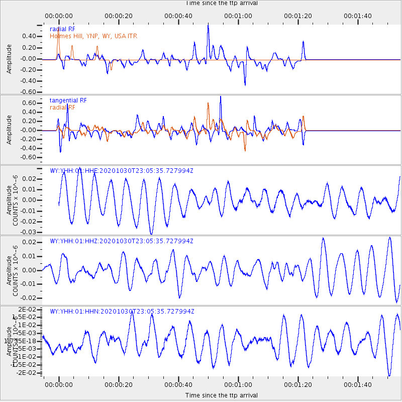
YHH Holmes Hill, YNP, WY, USA - Earthquake Result Viewer
*The percent match for this event was below the threshold and hence no stack was calculated.
| Earthquake location: |
Jan Mayen Island Region |
| Earthquake latitude/longitude: |
71.6/-3.3 |
| Earthquake time(UTC): |
2020/10/30 (304) 22:56:47 GMT |
| Earthquake Depth: |
10 km |
| Earthquake Magnitude: |
5.6 mww |
| Earthquake Catalog/Contributor: |
NEIC PDE/us |
|
| Network: |
WY Yellowstone Wyoming Seismic Network |
| Station: |
YHH Holmes Hill, YNP, WY, USA |
| Lat/Lon: |
44.79 N/110.85 W |
| Elevation: |
2717 m |
|
| Distance: |
53.3 deg |
| Az: |
302.13 deg |
| Baz: |
22.235 deg |
| Ray Param: |
$rayparam |
*The percent match for this event was below the threshold and hence was not used in the summary stack. |
|
| Radial Match: |
50.61203 % |
| Radial Bump: |
400 |
| Transverse Match: |
80.19144 % |
| Transverse Bump: |
400 |
| SOD ConfigId: |
23341671 |
| Insert Time: |
2020-11-14 00:17:08.367 +0000 |
| GWidth: |
2.5 |
| Max Bumps: |
400 |
| Tol: |
0.001 |
|
Signal To Noise
| Channel | StoN | STA | LTA |
| WY:YHH:01:HHZ:20201030T23:05:35.727994Z | 1.8295707 | 8.221063E-9 | 4.4934385E-9 |
| WY:YHH:01:HHN:20201030T23:05:35.727994Z | 0.355932 | 5.0508273E-9 | 1.41904275E-8 |
| WY:YHH:01:HHE:20201030T23:05:35.727994Z | 1.2412696 | 1.9128603E-8 | 1.5410514E-8 |
| Arrivals |
| Ps | |
| PpPs | |
| PsPs/PpSs | |


