You are here: Home > Network List > IU - Global Seismograph Network (GSN - IRIS/USGS) Stations List
> Station JOHN Johnston Island, USA > Earthquake Result Viewer
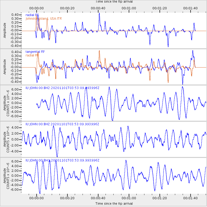
JOHN Johnston Island, USA - Earthquake Result Viewer
*The percent match for this event was below the threshold and hence no stack was calculated.
| Earthquake location: |
Banda Sea |
| Earthquake latitude/longitude: |
-7.1/129.2 |
| Earthquake time(UTC): |
2020/11/01 (306) 03:43:20 GMT |
| Earthquake Depth: |
181 km |
| Earthquake Magnitude: |
5.7 Mww |
| Earthquake Catalog/Contributor: |
NEIC PDE/us |
|
| Network: |
IU Global Seismograph Network (GSN - IRIS/USGS) |
| Station: |
JOHN Johnston Island, USA |
| Lat/Lon: |
16.73 N/169.53 W |
| Elevation: |
2.0 m |
|
| Distance: |
65.0 deg |
| Az: |
67.941 deg |
| Baz: |
253.741 deg |
| Ray Param: |
$rayparam |
*The percent match for this event was below the threshold and hence was not used in the summary stack. |
|
| Radial Match: |
51.97806 % |
| Radial Bump: |
291 |
| Transverse Match: |
43.11551 % |
| Transverse Bump: |
353 |
| SOD ConfigId: |
23341671 |
| Insert Time: |
2020-11-15 04:48:35.250 +0000 |
| GWidth: |
2.5 |
| Max Bumps: |
400 |
| Tol: |
0.001 |
|
Signal To Noise
| Channel | StoN | STA | LTA |
| IU:JOHN:00:BHZ:20201101T03:53:09.993996Z | 0.6376654 | 1.1923834E-6 | 1.8699201E-6 |
| IU:JOHN:00:BH1:20201101T03:53:09.993996Z | 2.1696548 | 4.7551075E-6 | 2.1916424E-6 |
| IU:JOHN:00:BH2:20201101T03:53:09.993996Z | 2.110294 | 4.9917007E-6 | 2.3654052E-6 |
| Arrivals |
| Ps | |
| PpPs | |
| PsPs/PpSs | |


