You are here: Home > Network List > TA - USArray Transportable Network (new EarthScope stations) Stations List
> Station L15K Ungalak Mountain, AK, USA > Earthquake Result Viewer
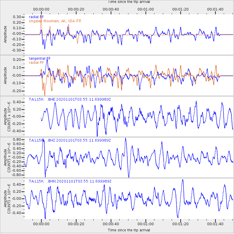
L15K Ungalak Mountain, AK, USA - Earthquake Result Viewer
*The percent match for this event was below the threshold and hence no stack was calculated.
| Earthquake location: |
Banda Sea |
| Earthquake latitude/longitude: |
-7.1/129.2 |
| Earthquake time(UTC): |
2020/11/01 (306) 03:43:20 GMT |
| Earthquake Depth: |
181 km |
| Earthquake Magnitude: |
5.7 Mww |
| Earthquake Catalog/Contributor: |
NEIC PDE/us |
|
| Network: |
TA USArray Transportable Network (new EarthScope stations) |
| Station: |
L15K Ungalak Mountain, AK, USA |
| Lat/Lon: |
61.68 N/161.49 W |
| Elevation: |
219 m |
|
| Distance: |
86.5 deg |
| Az: |
26.54 deg |
| Baz: |
248.423 deg |
| Ray Param: |
$rayparam |
*The percent match for this event was below the threshold and hence was not used in the summary stack. |
|
| Radial Match: |
60.334988 % |
| Radial Bump: |
400 |
| Transverse Match: |
51.793472 % |
| Transverse Bump: |
400 |
| SOD ConfigId: |
23341671 |
| Insert Time: |
2020-11-15 04:50:52.252 +0000 |
| GWidth: |
2.5 |
| Max Bumps: |
400 |
| Tol: |
0.001 |
|
Signal To Noise
| Channel | StoN | STA | LTA |
| TA:L15K: :BHZ:20201101T03:55:11.699989Z | 2.0803351 | 4.8004864E-7 | 2.3075543E-7 |
| TA:L15K: :BHN:20201101T03:55:11.699989Z | 1.8077981 | 2.5021868E-7 | 1.3841074E-7 |
| TA:L15K: :BHE:20201101T03:55:11.699989Z | 1.2003795 | 2.285753E-7 | 1.904192E-7 |
| Arrivals |
| Ps | |
| PpPs | |
| PsPs/PpSs | |


