You are here: Home > Network List > TA - USArray Transportable Network (new EarthScope stations) Stations List
> Station G21K Allakaket, AK, USA > Earthquake Result Viewer
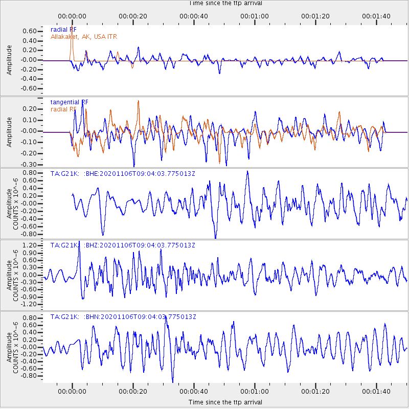
G21K Allakaket, AK, USA - Earthquake Result Viewer
*The percent match for this event was below the threshold and hence no stack was calculated.
| Earthquake location: |
Off East Coast Of Honshu, Japan |
| Earthquake latitude/longitude: |
41.0/143.3 |
| Earthquake time(UTC): |
2020/11/06 (311) 08:56:38 GMT |
| Earthquake Depth: |
16 km |
| Earthquake Magnitude: |
5.5 Mww |
| Earthquake Catalog/Contributor: |
NEIC PDE/us |
|
| Network: |
TA USArray Transportable Network (new EarthScope stations) |
| Station: |
G21K Allakaket, AK, USA |
| Lat/Lon: |
66.52 N/153.51 W |
| Elevation: |
446 m |
|
| Distance: |
42.7 deg |
| Az: |
31.868 deg |
| Baz: |
265.74 deg |
| Ray Param: |
$rayparam |
*The percent match for this event was below the threshold and hence was not used in the summary stack. |
|
| Radial Match: |
61.9344 % |
| Radial Bump: |
400 |
| Transverse Match: |
58.753498 % |
| Transverse Bump: |
374 |
| SOD ConfigId: |
23341671 |
| Insert Time: |
2020-11-20 10:14:15.472 +0000 |
| GWidth: |
2.5 |
| Max Bumps: |
400 |
| Tol: |
0.001 |
|
Signal To Noise
| Channel | StoN | STA | LTA |
| TA:G21K: :BHZ:20201106T09:04:03.775013Z | 2.171877 | 5.596215E-7 | 2.5766727E-7 |
| TA:G21K: :BHN:20201106T09:04:03.775013Z | 0.9852118 | 2.3724601E-7 | 2.408071E-7 |
| TA:G21K: :BHE:20201106T09:04:03.775013Z | 0.8135336 | 1.8744767E-7 | 2.304117E-7 |
| Arrivals |
| Ps | |
| PpPs | |
| PsPs/PpSs | |


