You are here: Home > Network List > US - United States National Seismic Network Stations List
> Station LAO LASA Array, Montana, USA > Earthquake Result Viewer
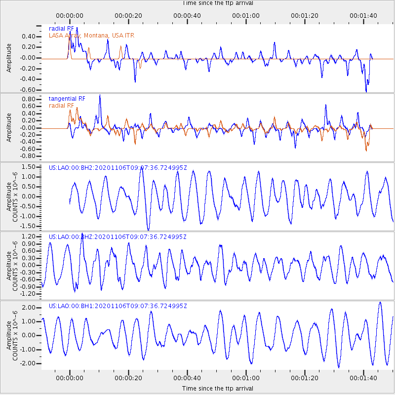
LAO LASA Array, Montana, USA - Earthquake Result Viewer
*The percent match for this event was below the threshold and hence no stack was calculated.
| Earthquake location: |
Off East Coast Of Honshu, Japan |
| Earthquake latitude/longitude: |
41.0/143.3 |
| Earthquake time(UTC): |
2020/11/06 (311) 08:56:38 GMT |
| Earthquake Depth: |
16 km |
| Earthquake Magnitude: |
5.5 Mww |
| Earthquake Catalog/Contributor: |
NEIC PDE/us |
|
| Network: |
US United States National Seismic Network |
| Station: |
LAO LASA Array, Montana, USA |
| Lat/Lon: |
46.69 N/106.22 W |
| Elevation: |
902 m |
|
| Distance: |
73.1 deg |
| Az: |
42.37 deg |
| Baz: |
312.18 deg |
| Ray Param: |
$rayparam |
*The percent match for this event was below the threshold and hence was not used in the summary stack. |
|
| Radial Match: |
41.628567 % |
| Radial Bump: |
393 |
| Transverse Match: |
76.29028 % |
| Transverse Bump: |
304 |
| SOD ConfigId: |
23341671 |
| Insert Time: |
2020-11-20 10:16:12.134 +0000 |
| GWidth: |
2.5 |
| Max Bumps: |
400 |
| Tol: |
0.001 |
|
Signal To Noise
| Channel | StoN | STA | LTA |
| US:LAO:00:BHZ:20201106T09:07:36.724995Z | 1.8112644 | 7.970755E-7 | 4.4006578E-7 |
| US:LAO:00:BH1:20201106T09:07:36.724995Z | 0.9946997 | 7.4720674E-7 | 7.511883E-7 |
| US:LAO:00:BH2:20201106T09:07:36.724995Z | 0.8406188 | 5.114733E-7 | 6.0844854E-7 |
| Arrivals |
| Ps | |
| PpPs | |
| PsPs/PpSs | |


