You are here: Home > Network List > US - United States National Seismic Network Stations List
> Station ELK Elko, Nevada, USA > Earthquake Result Viewer
ELK Elko, Nevada, USA - Earthquake Result Viewer
*The percent match for this event was below the threshold and hence no stack was calculated.
| Earthquake location: |
Mariana Islands |
| Earthquake latitude/longitude: |
18.7/145.7 |
| Earthquake time(UTC): |
2017/09/14 (257) 17:41:28 GMT |
| Earthquake Depth: |
173 km |
| Earthquake Magnitude: |
5.8 mww |
| Earthquake Catalog/Contributor: |
NEIC PDE/us |
|
| Network: |
US United States National Seismic Network |
| Station: |
ELK Elko, Nevada, USA |
| Lat/Lon: |
40.74 N/115.24 W |
| Elevation: |
2210 m |
|
| Distance: |
84.6 deg |
| Az: |
48.912 deg |
| Baz: |
289.876 deg |
| Ray Param: |
$rayparam |
*The percent match for this event was below the threshold and hence was not used in the summary stack. |
|
| Radial Match: |
68.87576 % |
| Radial Bump: |
400 |
| Transverse Match: |
55.01101 % |
| Transverse Bump: |
400 |
| SOD ConfigId: |
2307692 |
| Insert Time: |
2017-09-28 17:46:54.279 +0000 |
| GWidth: |
2.5 |
| Max Bumps: |
400 |
| Tol: |
0.001 |
|
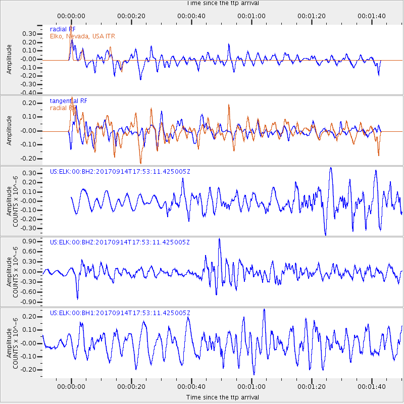
Signal To Noise
| Channel | StoN | STA | LTA |
| US:ELK:00:BHZ:20170914T17:53:11.425005Z | 6.1258926 | 2.7171745E-7 | 4.435557E-8 |
| US:ELK:00:BH1:20170914T17:53:11.425005Z | 2.0618355 | 9.049311E-8 | 4.3889585E-8 |
| US:ELK:00:BH2:20170914T17:53:11.425005Z | 0.94725746 | 6.6814074E-8 | 7.053423E-8 |
| Arrivals |
| Ps | |
| PpPs | |
| PsPs/PpSs | |


