You are here: Home > Network List > UU - University of Utah Regional Network Stations List
> Station FORU South Mineral Mountains, UT, USA > Earthquake Result Viewer
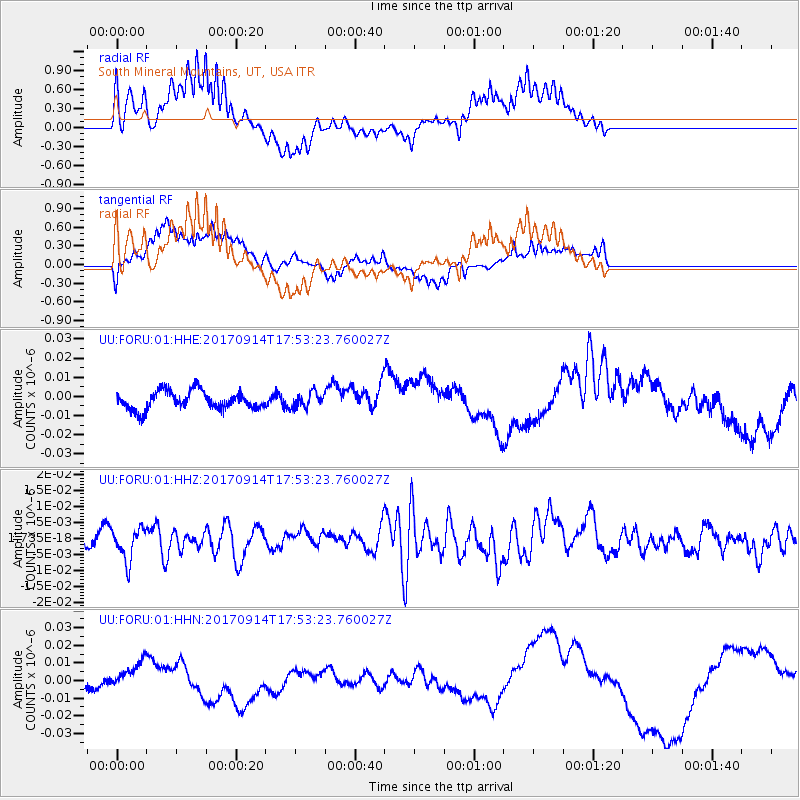
FORU South Mineral Mountains, UT, USA - Earthquake Result Viewer
*The percent match for this event was below the threshold and hence no stack was calculated.
| Earthquake location: |
Mariana Islands |
| Earthquake latitude/longitude: |
18.7/145.7 |
| Earthquake time(UTC): |
2017/09/14 (257) 17:41:28 GMT |
| Earthquake Depth: |
173 km |
| Earthquake Magnitude: |
5.8 mww |
| Earthquake Catalog/Contributor: |
NEIC PDE/us |
|
| Network: |
UU University of Utah Regional Network |
| Station: |
FORU South Mineral Mountains, UT, USA |
| Lat/Lon: |
38.46 N/112.86 W |
| Elevation: |
1840 m |
|
| Distance: |
87.1 deg |
| Az: |
50.402 deg |
| Baz: |
291.493 deg |
| Ray Param: |
$rayparam |
*The percent match for this event was below the threshold and hence was not used in the summary stack. |
|
| Radial Match: |
60.52619 % |
| Radial Bump: |
400 |
| Transverse Match: |
37.98085 % |
| Transverse Bump: |
400 |
| SOD ConfigId: |
2307692 |
| Insert Time: |
2017-09-28 17:47:32.669 +0000 |
| GWidth: |
2.5 |
| Max Bumps: |
400 |
| Tol: |
0.001 |
|
Signal To Noise
| Channel | StoN | STA | LTA |
| UU:FORU:01:HHZ:20170914T17:53:23.760027Z | 1.6566148 | 5.1067874E-9 | 3.0826643E-9 |
| UU:FORU:01:HHN:20170914T17:53:23.760027Z | 1.9597926 | 8.449196E-9 | 4.3112705E-9 |
| UU:FORU:01:HHE:20170914T17:53:23.760027Z | 0.820455 | 3.867156E-9 | 4.7134283E-9 |
| Arrivals |
| Ps | |
| PpPs | |
| PsPs/PpSs | |


