You are here: Home > Network List > CI - Caltech Regional Seismic Network Stations List
> Station MPM Manuel Prospect Mine, California, USA > Earthquake Result Viewer
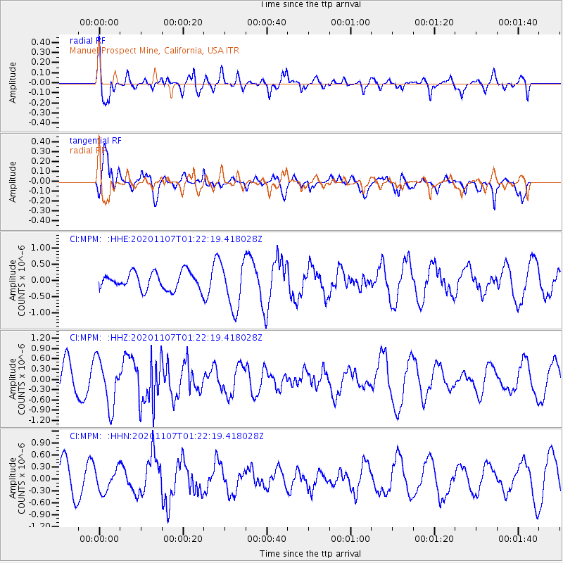
MPM Manuel Prospect Mine, California, USA - Earthquake Result Viewer
*The percent match for this event was below the threshold and hence no stack was calculated.
| Earthquake location: |
Volcano Islands, Japan Region |
| Earthquake latitude/longitude: |
25.7/143.6 |
| Earthquake time(UTC): |
2020/11/07 (312) 01:10:32 GMT |
| Earthquake Depth: |
18 km |
| Earthquake Magnitude: |
5.8 mww |
| Earthquake Catalog/Contributor: |
NEIC PDE/us |
|
| Network: |
CI Caltech Regional Seismic Network |
| Station: |
MPM Manuel Prospect Mine, California, USA |
| Lat/Lon: |
36.06 N/117.49 W |
| Elevation: |
185 m |
|
| Distance: |
82.0 deg |
| Az: |
53.951 deg |
| Baz: |
295.802 deg |
| Ray Param: |
$rayparam |
*The percent match for this event was below the threshold and hence was not used in the summary stack. |
|
| Radial Match: |
63.708614 % |
| Radial Bump: |
400 |
| Transverse Match: |
75.22913 % |
| Transverse Bump: |
372 |
| SOD ConfigId: |
23341671 |
| Insert Time: |
2020-11-21 02:18:53.271 +0000 |
| GWidth: |
2.5 |
| Max Bumps: |
400 |
| Tol: |
0.001 |
|
Signal To Noise
| Channel | StoN | STA | LTA |
| CI:MPM: :HHZ:20201107T01:22:19.418028Z | 2.1203227 | 6.9429205E-7 | 3.274464E-7 |
| CI:MPM: :HHN:20201107T01:22:19.418028Z | 0.8491583 | 2.8001614E-7 | 3.2975728E-7 |
| CI:MPM: :HHE:20201107T01:22:19.418028Z | 2.7534225 | 7.1612743E-7 | 2.6008627E-7 |
| Arrivals |
| Ps | |
| PpPs | |
| PsPs/PpSs | |


