You are here: Home > Network List > TA - USArray Transportable Network (new EarthScope stations) Stations List
> Station H31M Peel River, Yukon, CAN > Earthquake Result Viewer
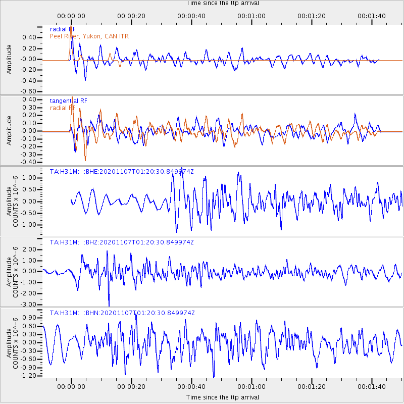
H31M Peel River, Yukon, CAN - Earthquake Result Viewer
*The percent match for this event was below the threshold and hence no stack was calculated.
| Earthquake location: |
Volcano Islands, Japan Region |
| Earthquake latitude/longitude: |
25.7/143.6 |
| Earthquake time(UTC): |
2020/11/07 (312) 01:10:32 GMT |
| Earthquake Depth: |
18 km |
| Earthquake Magnitude: |
5.8 mww |
| Earthquake Catalog/Contributor: |
NEIC PDE/us |
|
| Network: |
TA USArray Transportable Network (new EarthScope stations) |
| Station: |
H31M Peel River, Yukon, CAN |
| Lat/Lon: |
65.81 N/134.34 W |
| Elevation: |
642 m |
|
| Distance: |
63.6 deg |
| Az: |
27.104 deg |
| Baz: |
274.077 deg |
| Ray Param: |
$rayparam |
*The percent match for this event was below the threshold and hence was not used in the summary stack. |
|
| Radial Match: |
67.04989 % |
| Radial Bump: |
400 |
| Transverse Match: |
57.259953 % |
| Transverse Bump: |
400 |
| SOD ConfigId: |
23341671 |
| Insert Time: |
2020-11-21 02:28:19.440 +0000 |
| GWidth: |
2.5 |
| Max Bumps: |
400 |
| Tol: |
0.001 |
|
Signal To Noise
| Channel | StoN | STA | LTA |
| TA:H31M: :BHZ:20201107T01:20:30.849974Z | 4.7789016 | 8.1706213E-7 | 1.7097278E-7 |
| TA:H31M: :BHN:20201107T01:20:30.849974Z | 0.86291397 | 2.6143934E-7 | 3.0297267E-7 |
| TA:H31M: :BHE:20201107T01:20:30.849974Z | 1.8861762 | 4.7464226E-7 | 2.5164258E-7 |
| Arrivals |
| Ps | |
| PpPs | |
| PsPs/PpSs | |


