You are here: Home > Network List > TA - USArray Transportable Network (new EarthScope stations) Stations List
> Station O17K Koliganek, Bristol Bay, AK, USA > Earthquake Result Viewer
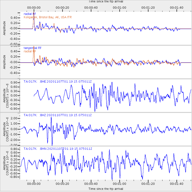
O17K Koliganek, Bristol Bay, AK, USA - Earthquake Result Viewer
*The percent match for this event was below the threshold and hence no stack was calculated.
| Earthquake location: |
Volcano Islands, Japan Region |
| Earthquake latitude/longitude: |
25.7/143.6 |
| Earthquake time(UTC): |
2020/11/07 (312) 01:10:32 GMT |
| Earthquake Depth: |
18 km |
| Earthquake Magnitude: |
5.8 mww |
| Earthquake Catalog/Contributor: |
NEIC PDE/us |
|
| Network: |
TA USArray Transportable Network (new EarthScope stations) |
| Station: |
O17K Koliganek, Bristol Bay, AK, USA |
| Lat/Lon: |
59.77 N/157.09 W |
| Elevation: |
156 m |
|
| Distance: |
52.8 deg |
| Az: |
33.114 deg |
| Baz: |
256.972 deg |
| Ray Param: |
$rayparam |
*The percent match for this event was below the threshold and hence was not used in the summary stack. |
|
| Radial Match: |
61.410725 % |
| Radial Bump: |
400 |
| Transverse Match: |
61.464684 % |
| Transverse Bump: |
400 |
| SOD ConfigId: |
23341671 |
| Insert Time: |
2020-11-21 02:28:56.506 +0000 |
| GWidth: |
2.5 |
| Max Bumps: |
400 |
| Tol: |
0.001 |
|
Signal To Noise
| Channel | StoN | STA | LTA |
| TA:O17K: :BHZ:20201107T01:19:15.075011Z | 2.2048094 | 5.828319E-7 | 2.643457E-7 |
| TA:O17K: :BHN:20201107T01:19:15.075011Z | 0.6631056 | 1.5171847E-7 | 2.2879985E-7 |
| TA:O17K: :BHE:20201107T01:19:15.075011Z | 1.5043163 | 3.7766836E-7 | 2.5105646E-7 |
| Arrivals |
| Ps | |
| PpPs | |
| PsPs/PpSs | |


