You are here: Home > Network List > CN - Canadian National Seismograph Network Stations List
> Station INK INUVIK, NT > Earthquake Result Viewer
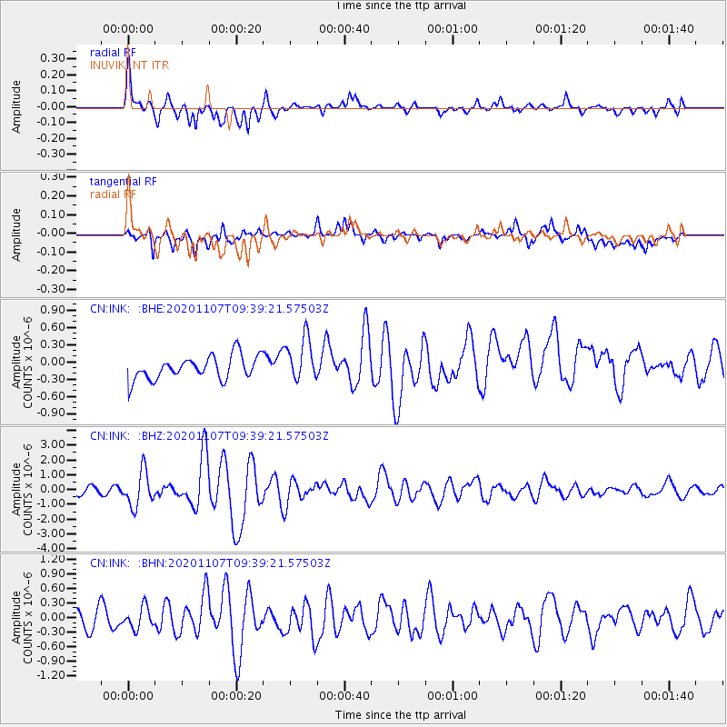
INK INUVIK, NT - Earthquake Result Viewer
*The percent match for this event was below the threshold and hence no stack was calculated.
| Earthquake location: |
Tonga Islands |
| Earthquake latitude/longitude: |
-15.3/-173.6 |
| Earthquake time(UTC): |
2020/11/07 (312) 09:27:04 GMT |
| Earthquake Depth: |
29 km |
| Earthquake Magnitude: |
6.1 Mww |
| Earthquake Catalog/Contributor: |
NEIC PDE/us |
|
| Network: |
CN Canadian National Seismograph Network |
| Station: |
INK INUVIK, NT |
| Lat/Lon: |
68.31 N/133.53 W |
| Elevation: |
44 m |
|
| Distance: |
88.2 deg |
| Az: |
13.844 deg |
| Baz: |
218.399 deg |
| Ray Param: |
$rayparam |
*The percent match for this event was below the threshold and hence was not used in the summary stack. |
|
| Radial Match: |
75.6959 % |
| Radial Bump: |
400 |
| Transverse Match: |
64.99117 % |
| Transverse Bump: |
400 |
| SOD ConfigId: |
23341671 |
| Insert Time: |
2020-11-21 10:41:06.164 +0000 |
| GWidth: |
2.5 |
| Max Bumps: |
400 |
| Tol: |
0.001 |
|
Signal To Noise
| Channel | StoN | STA | LTA |
| CN:INK: :BHZ:20201107T09:39:21.57503Z | 5.2477407 | 1.1944146E-6 | 2.2760548E-7 |
| CN:INK: :BHN:20201107T09:39:21.57503Z | 1.3401423 | 2.2597989E-7 | 1.6862381E-7 |
| CN:INK: :BHE:20201107T09:39:21.57503Z | 1.8997571 | 3.854043E-7 | 2.028703E-7 |
| Arrivals |
| Ps | |
| PpPs | |
| PsPs/PpSs | |


