You are here: Home > Network List > US - United States National Seismic Network Stations List
> Station EGMT Eagleton, Montana, USA > Earthquake Result Viewer
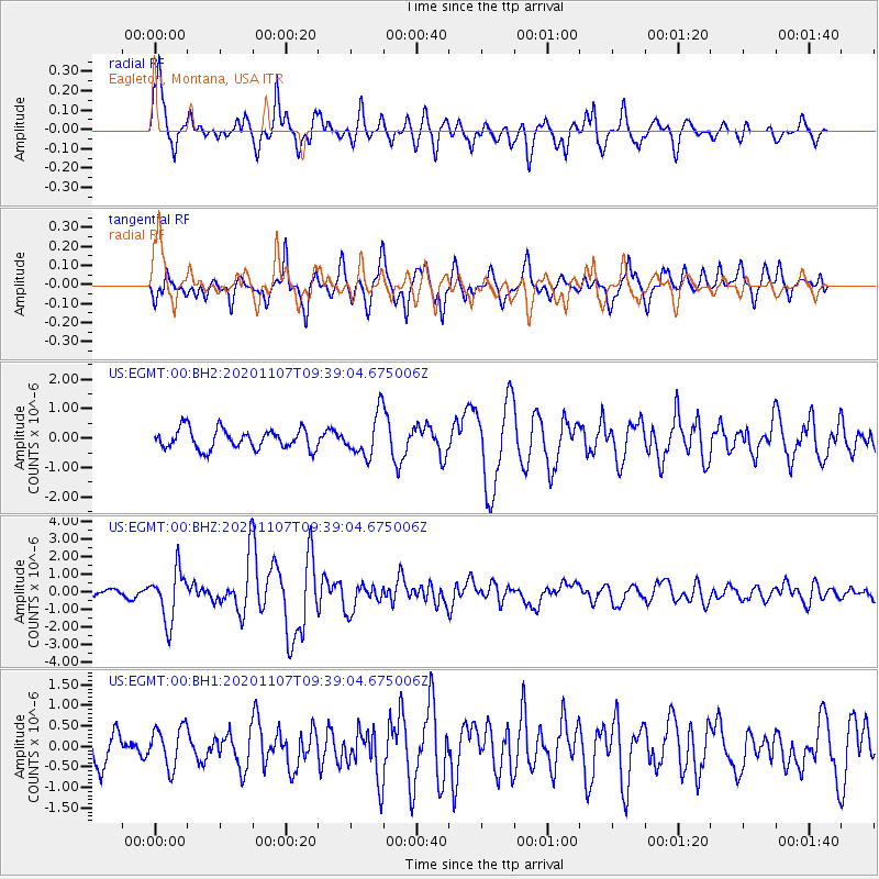
EGMT Eagleton, Montana, USA - Earthquake Result Viewer
*The percent match for this event was below the threshold and hence no stack was calculated.
| Earthquake location: |
Tonga Islands |
| Earthquake latitude/longitude: |
-15.3/-173.6 |
| Earthquake time(UTC): |
2020/11/07 (312) 09:27:04 GMT |
| Earthquake Depth: |
29 km |
| Earthquake Magnitude: |
6.1 Mww |
| Earthquake Catalog/Contributor: |
NEIC PDE/us |
|
| Network: |
US United States National Seismic Network |
| Station: |
EGMT Eagleton, Montana, USA |
| Lat/Lon: |
48.02 N/109.75 W |
| Elevation: |
1055 m |
|
| Distance: |
84.7 deg |
| Az: |
37.223 deg |
| Baz: |
240.423 deg |
| Ray Param: |
$rayparam |
*The percent match for this event was below the threshold and hence was not used in the summary stack. |
|
| Radial Match: |
74.24881 % |
| Radial Bump: |
400 |
| Transverse Match: |
75.19039 % |
| Transverse Bump: |
400 |
| SOD ConfigId: |
23341671 |
| Insert Time: |
2020-11-21 10:56:17.733 +0000 |
| GWidth: |
2.5 |
| Max Bumps: |
400 |
| Tol: |
0.001 |
|
Signal To Noise
| Channel | StoN | STA | LTA |
| US:EGMT:00:BHZ:20201107T09:39:04.675006Z | 5.996872 | 1.4399589E-6 | 2.401183E-7 |
| US:EGMT:00:BH1:20201107T09:39:04.675006Z | 1.0258954 | 4.978229E-7 | 4.8525703E-7 |
| US:EGMT:00:BH2:20201107T09:39:04.675006Z | 2.1373525 | 7.2081946E-7 | 3.3724876E-7 |
| Arrivals |
| Ps | |
| PpPs | |
| PsPs/PpSs | |


