You are here: Home > Network List > US - United States National Seismic Network Stations List
> Station WMOK Wichita Mountains, Oklahoma, USA > Earthquake Result Viewer
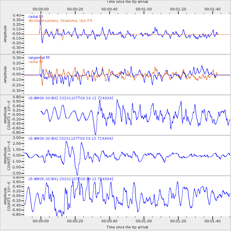
WMOK Wichita Mountains, Oklahoma, USA - Earthquake Result Viewer
*The percent match for this event was below the threshold and hence no stack was calculated.
| Earthquake location: |
Tonga Islands |
| Earthquake latitude/longitude: |
-15.3/-173.6 |
| Earthquake time(UTC): |
2020/11/07 (312) 09:27:04 GMT |
| Earthquake Depth: |
29 km |
| Earthquake Magnitude: |
6.1 Mww |
| Earthquake Catalog/Contributor: |
NEIC PDE/us |
|
| Network: |
US United States National Seismic Network |
| Station: |
WMOK Wichita Mountains, Oklahoma, USA |
| Lat/Lon: |
34.74 N/98.78 W |
| Elevation: |
486 m |
|
| Distance: |
86.6 deg |
| Az: |
52.76 deg |
| Baz: |
248.901 deg |
| Ray Param: |
$rayparam |
*The percent match for this event was below the threshold and hence was not used in the summary stack. |
|
| Radial Match: |
54.18767 % |
| Radial Bump: |
400 |
| Transverse Match: |
43.643456 % |
| Transverse Bump: |
400 |
| SOD ConfigId: |
23341671 |
| Insert Time: |
2020-11-21 10:56:50.435 +0000 |
| GWidth: |
2.5 |
| Max Bumps: |
400 |
| Tol: |
0.001 |
|
Signal To Noise
| Channel | StoN | STA | LTA |
| US:WMOK:00:BHZ:20201107T09:39:13.724994Z | 2.1670268 | 5.2237687E-7 | 2.4105694E-7 |
| US:WMOK:00:BH1:20201107T09:39:13.724994Z | 1.1778725 | 3.3860266E-7 | 2.874697E-7 |
| US:WMOK:00:BH2:20201107T09:39:13.724994Z | 2.6097088 | 4.7239644E-7 | 1.8101501E-7 |
| Arrivals |
| Ps | |
| PpPs | |
| PsPs/PpSs | |


