You are here: Home > Network List > UU - University of Utah Regional Network Stations List
> Station FORU South Mineral Mountains, UT, USA > Earthquake Result Viewer
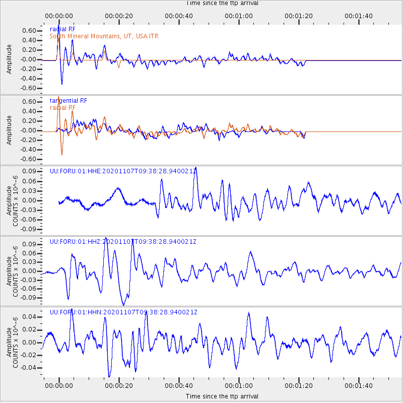
FORU South Mineral Mountains, UT, USA - Earthquake Result Viewer
*The percent match for this event was below the threshold and hence no stack was calculated.
| Earthquake location: |
Tonga Islands |
| Earthquake latitude/longitude: |
-15.3/-173.6 |
| Earthquake time(UTC): |
2020/11/07 (312) 09:27:04 GMT |
| Earthquake Depth: |
29 km |
| Earthquake Magnitude: |
6.1 Mww |
| Earthquake Catalog/Contributor: |
NEIC PDE/us |
|
| Network: |
UU University of Utah Regional Network |
| Station: |
FORU South Mineral Mountains, UT, USA |
| Lat/Lon: |
38.46 N/112.86 W |
| Elevation: |
1840 m |
|
| Distance: |
78.0 deg |
| Az: |
44.431 deg |
| Baz: |
239.383 deg |
| Ray Param: |
$rayparam |
*The percent match for this event was below the threshold and hence was not used in the summary stack. |
|
| Radial Match: |
65.30527 % |
| Radial Bump: |
400 |
| Transverse Match: |
58.785984 % |
| Transverse Bump: |
400 |
| SOD ConfigId: |
23341671 |
| Insert Time: |
2020-11-21 10:57:13.362 +0000 |
| GWidth: |
2.5 |
| Max Bumps: |
400 |
| Tol: |
0.001 |
|
Signal To Noise
| Channel | StoN | STA | LTA |
| UU:FORU:01:HHZ:20201107T09:38:28.940021Z | 6.131155 | 3.9867437E-8 | 6.502435E-9 |
| UU:FORU:01:HHN:20201107T09:38:28.940021Z | 1.2200426 | 2.119444E-8 | 1.7371885E-8 |
| UU:FORU:01:HHE:20201107T09:38:28.940021Z | 1.873932 | 2.9071863E-8 | 1.551383E-8 |
| Arrivals |
| Ps | |
| PpPs | |
| PsPs/PpSs | |


