You are here: Home > Network List > PF - Volcanologic Network of Piton de Fournaise-OVPF Stations List
> Station HIM cratere Himiltrude > Earthquake Result Viewer
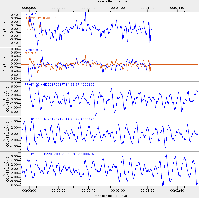
HIM cratere Himiltrude - Earthquake Result Viewer
*The percent match for this event was below the threshold and hence no stack was calculated.
| Earthquake location: |
New Britain Region, P.N.G. |
| Earthquake latitude/longitude: |
-6.3/148.9 |
| Earthquake time(UTC): |
2017/09/17 (260) 14:26:08 GMT |
| Earthquake Depth: |
22 km |
| Earthquake Magnitude: |
5.7 Mww |
| Earthquake Catalog/Contributor: |
NEIC PDE/us |
|
| Network: |
PF Volcanologic Network of Piton de Fournaise-OVPF |
| Station: |
HIM cratere Himiltrude |
| Lat/Lon: |
21.21 S/55.72 E |
| Elevation: |
1958 m |
|
| Distance: |
90.7 deg |
| Az: |
248.706 deg |
| Baz: |
96.983 deg |
| Ray Param: |
$rayparam |
*The percent match for this event was below the threshold and hence was not used in the summary stack. |
|
| Radial Match: |
49.026005 % |
| Radial Bump: |
400 |
| Transverse Match: |
54.306995 % |
| Transverse Bump: |
400 |
| SOD ConfigId: |
2341311 |
| Insert Time: |
2017-10-01 15:51:29.553 +0000 |
| GWidth: |
2.5 |
| Max Bumps: |
400 |
| Tol: |
0.001 |
|
Signal To Noise
| Channel | StoN | STA | LTA |
| PF:HIM:00:HHZ:20170917T14:38:37.400029Z | 2.0024495 | 3.483602E-6 | 1.7396703E-6 |
| PF:HIM:00:HHN:20170917T14:38:37.400029Z | 2.0324345 | 3.543799E-6 | 1.7436228E-6 |
| PF:HIM:00:HHE:20170917T14:38:37.400029Z | 0.49426514 | 1.2999275E-6 | 2.6300204E-6 |
| Arrivals |
| Ps | |
| PpPs | |
| PsPs/PpSs | |


