You are here: Home > Network List > UW - Pacific Northwest Regional Seismic Network Stations List
> Station IRON Crane, OR, USA > Earthquake Result Viewer
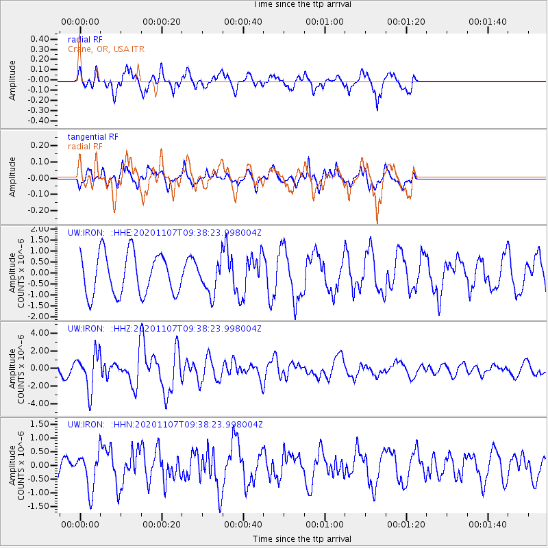
IRON Crane, OR, USA - Earthquake Result Viewer
*The percent match for this event was below the threshold and hence no stack was calculated.
| Earthquake location: |
Tonga Islands |
| Earthquake latitude/longitude: |
-15.3/-173.6 |
| Earthquake time(UTC): |
2020/11/07 (312) 09:27:04 GMT |
| Earthquake Depth: |
29 km |
| Earthquake Magnitude: |
6.1 Mww |
| Earthquake Catalog/Contributor: |
NEIC PDE/us |
|
| Network: |
UW Pacific Northwest Regional Seismic Network |
| Station: |
IRON Crane, OR, USA |
| Lat/Lon: |
43.36 N/118.47 W |
| Elevation: |
1226 m |
|
| Distance: |
77.1 deg |
| Az: |
37.855 deg |
| Baz: |
234.293 deg |
| Ray Param: |
$rayparam |
*The percent match for this event was below the threshold and hence was not used in the summary stack. |
|
| Radial Match: |
52.249374 % |
| Radial Bump: |
400 |
| Transverse Match: |
58.38972 % |
| Transverse Bump: |
400 |
| SOD ConfigId: |
23341671 |
| Insert Time: |
2020-11-21 10:58:15.549 +0000 |
| GWidth: |
2.5 |
| Max Bumps: |
400 |
| Tol: |
0.001 |
|
Signal To Noise
| Channel | StoN | STA | LTA |
| UW:IRON: :HHZ:20201107T09:38:23.998004Z | 3.1628106 | 2.1654437E-6 | 6.8465806E-7 |
| UW:IRON: :HHN:20201107T09:38:23.998004Z | 1.2797209 | 6.9221943E-7 | 5.4091436E-7 |
| UW:IRON: :HHE:20201107T09:38:23.998004Z | 0.79199284 | 7.3830444E-7 | 9.32211E-7 |
| Arrivals |
| Ps | |
| PpPs | |
| PsPs/PpSs | |


