You are here: Home > Network List > CI - Caltech Regional Seismic Network Stations List
> Station MPM Manuel Prospect Mine, California, USA > Earthquake Result Viewer
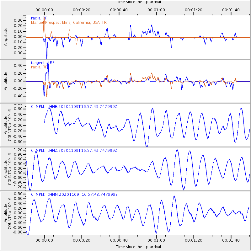
MPM Manuel Prospect Mine, California, USA - Earthquake Result Viewer
*The percent match for this event was below the threshold and hence no stack was calculated.
| Earthquake location: |
New Ireland Region, P.N.G. |
| Earthquake latitude/longitude: |
-3.8/153.3 |
| Earthquake time(UTC): |
2020/11/09 (314) 16:45:33 GMT |
| Earthquake Depth: |
215 km |
| Earthquake Magnitude: |
5.5 Mww |
| Earthquake Catalog/Contributor: |
NEIC PDE/us |
|
| Network: |
CI Caltech Regional Seismic Network |
| Station: |
MPM Manuel Prospect Mine, California, USA |
| Lat/Lon: |
36.06 N/117.49 W |
| Elevation: |
185 m |
|
| Distance: |
91.5 deg |
| Az: |
54.145 deg |
| Baz: |
266.458 deg |
| Ray Param: |
$rayparam |
*The percent match for this event was below the threshold and hence was not used in the summary stack. |
|
| Radial Match: |
58.596455 % |
| Radial Bump: |
400 |
| Transverse Match: |
73.7323 % |
| Transverse Bump: |
400 |
| SOD ConfigId: |
23341671 |
| Insert Time: |
2020-11-23 17:51:33.609 +0000 |
| GWidth: |
2.5 |
| Max Bumps: |
400 |
| Tol: |
0.001 |
|
Signal To Noise
| Channel | StoN | STA | LTA |
| CI:MPM: :HHZ:20201109T16:57:43.747999Z | 0.577621 | 5.2071306E-7 | 9.014787E-7 |
| CI:MPM: :HHN:20201109T16:57:43.747999Z | 0.7414877 | 4.5220455E-7 | 6.0986116E-7 |
| CI:MPM: :HHE:20201109T16:57:43.747999Z | 1.5720177 | 3.397463E-7 | 2.1612117E-7 |
| Arrivals |
| Ps | |
| PpPs | |
| PsPs/PpSs | |


