You are here: Home > Network List > TA - USArray Transportable Network (new EarthScope stations) Stations List
> Station G21K Allakaket, AK, USA > Earthquake Result Viewer
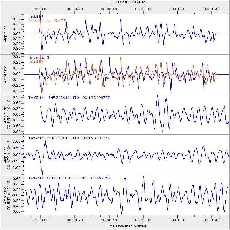
G21K Allakaket, AK, USA - Earthquake Result Viewer
*The percent match for this event was below the threshold and hence no stack was calculated.
| Earthquake location: |
Fiji Islands Region |
| Earthquake latitude/longitude: |
-19.7/-177.6 |
| Earthquake time(UTC): |
2020/11/11 (316) 00:48:43 GMT |
| Earthquake Depth: |
417 km |
| Earthquake Magnitude: |
6.0 Mww |
| Earthquake Catalog/Contributor: |
NEIC PDE/us |
|
| Network: |
TA USArray Transportable Network (new EarthScope stations) |
| Station: |
G21K Allakaket, AK, USA |
| Lat/Lon: |
66.52 N/153.51 W |
| Elevation: |
446 m |
|
| Distance: |
87.9 deg |
| Az: |
9.405 deg |
| Baz: |
202.587 deg |
| Ray Param: |
$rayparam |
*The percent match for this event was below the threshold and hence was not used in the summary stack. |
|
| Radial Match: |
49.010536 % |
| Radial Bump: |
400 |
| Transverse Match: |
59.559322 % |
| Transverse Bump: |
400 |
| SOD ConfigId: |
23341671 |
| Insert Time: |
2020-11-25 02:06:53.386 +0000 |
| GWidth: |
2.5 |
| Max Bumps: |
400 |
| Tol: |
0.001 |
|
Signal To Noise
| Channel | StoN | STA | LTA |
| TA:G21K: :BHZ:20201111T01:00:16.399975Z | 2.8249812 | 7.160268E-7 | 2.5346247E-7 |
| TA:G21K: :BHN:20201111T01:00:16.399975Z | 1.2636709 | 2.4830553E-7 | 1.9649539E-7 |
| TA:G21K: :BHE:20201111T01:00:16.399975Z | 0.8826757 | 2.3661849E-7 | 2.6806956E-7 |
| Arrivals |
| Ps | |
| PpPs | |
| PsPs/PpSs | |


