You are here: Home > Network List > TX - Texas Seismological Network Stations List
> Station WTFS Witchita Falls > Earthquake Result Viewer
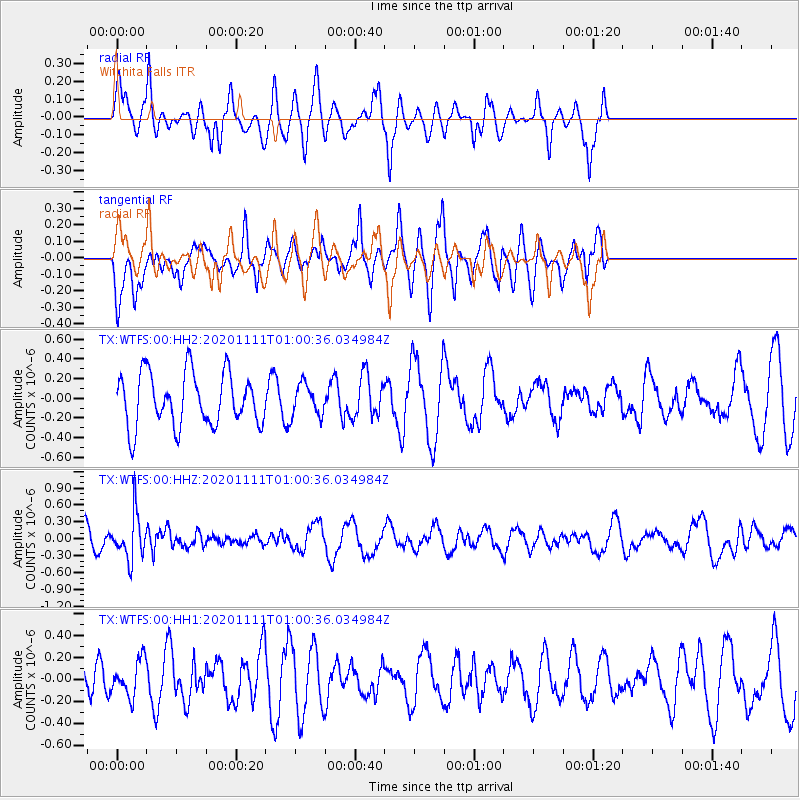
WTFS Witchita Falls - Earthquake Result Viewer
*The percent match for this event was below the threshold and hence no stack was calculated.
| Earthquake location: |
Fiji Islands Region |
| Earthquake latitude/longitude: |
-19.7/-177.6 |
| Earthquake time(UTC): |
2020/11/11 (316) 00:48:43 GMT |
| Earthquake Depth: |
417 km |
| Earthquake Magnitude: |
6.0 Mww |
| Earthquake Catalog/Contributor: |
NEIC PDE/us |
|
| Network: |
TX Texas Seismological Network |
| Station: |
WTFS Witchita Falls |
| Lat/Lon: |
33.77 N/98.46 W |
| Elevation: |
277 m |
|
| Distance: |
92.1 deg |
| Az: |
54.938 deg |
| Baz: |
247.752 deg |
| Ray Param: |
$rayparam |
*The percent match for this event was below the threshold and hence was not used in the summary stack. |
|
| Radial Match: |
60.99413 % |
| Radial Bump: |
345 |
| Transverse Match: |
55.52928 % |
| Transverse Bump: |
400 |
| SOD ConfigId: |
23341671 |
| Insert Time: |
2020-11-25 02:09:08.240 +0000 |
| GWidth: |
2.5 |
| Max Bumps: |
400 |
| Tol: |
0.001 |
|
Signal To Noise
| Channel | StoN | STA | LTA |
| TX:WTFS:00:HHZ:20201111T01:00:36.034984Z | 2.626811 | 3.9845736E-7 | 1.5168862E-7 |
| TX:WTFS:00:HH1:20201111T01:00:36.034984Z | 0.791411 | 1.6112217E-7 | 2.035885E-7 |
| TX:WTFS:00:HH2:20201111T01:00:36.034984Z | 0.6125316 | 1.6335119E-7 | 2.6668206E-7 |
| Arrivals |
| Ps | |
| PpPs | |
| PsPs/PpSs | |


