You are here: Home > Network List > US - United States National Seismic Network Stations List
> Station MNTX Cornudas Mountains, Texas, USA > Earthquake Result Viewer
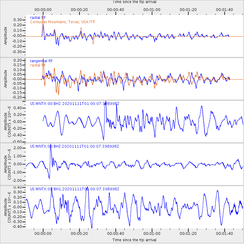
MNTX Cornudas Mountains, Texas, USA - Earthquake Result Viewer
*The percent match for this event was below the threshold and hence no stack was calculated.
| Earthquake location: |
Fiji Islands Region |
| Earthquake latitude/longitude: |
-19.7/-177.6 |
| Earthquake time(UTC): |
2020/11/11 (316) 00:48:43 GMT |
| Earthquake Depth: |
417 km |
| Earthquake Magnitude: |
6.0 Mww |
| Earthquake Catalog/Contributor: |
NEIC PDE/us |
|
| Network: |
US United States National Seismic Network |
| Station: |
MNTX Cornudas Mountains, Texas, USA |
| Lat/Lon: |
31.70 N/105.38 W |
| Elevation: |
404 m |
|
| Distance: |
86.0 deg |
| Az: |
54.436 deg |
| Baz: |
244.017 deg |
| Ray Param: |
$rayparam |
*The percent match for this event was below the threshold and hence was not used in the summary stack. |
|
| Radial Match: |
51.69446 % |
| Radial Bump: |
400 |
| Transverse Match: |
45.953163 % |
| Transverse Bump: |
400 |
| SOD ConfigId: |
23341671 |
| Insert Time: |
2020-11-25 02:10:01.580 +0000 |
| GWidth: |
2.5 |
| Max Bumps: |
400 |
| Tol: |
0.001 |
|
Signal To Noise
| Channel | StoN | STA | LTA |
| US:MNTX:00:BHZ:20201111T01:00:07.398998Z | 8.646782 | 9.921595E-7 | 1.147432E-7 |
| US:MNTX:00:BH1:20201111T01:00:07.398998Z | 1.3716031 | 1.4103225E-7 | 1.0282293E-7 |
| US:MNTX:00:BH2:20201111T01:00:07.398998Z | 2.0966918 | 2.985986E-7 | 1.4241415E-7 |
| Arrivals |
| Ps | |
| PpPs | |
| PsPs/PpSs | |


