You are here: Home > Network List > CI - Caltech Regional Seismic Network Stations List
> Station MPM Manuel Prospect Mine, California, USA > Earthquake Result Viewer
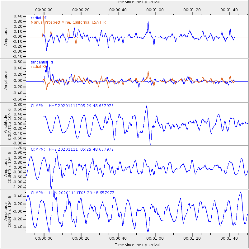
MPM Manuel Prospect Mine, California, USA - Earthquake Result Viewer
*The percent match for this event was below the threshold and hence no stack was calculated.
| Earthquake location: |
Volcano Islands, Japan Region |
| Earthquake latitude/longitude: |
25.5/142.8 |
| Earthquake time(UTC): |
2020/11/11 (316) 05:17:56 GMT |
| Earthquake Depth: |
10 km |
| Earthquake Magnitude: |
5.7 Mww |
| Earthquake Catalog/Contributor: |
NEIC PDE/us |
|
| Network: |
CI Caltech Regional Seismic Network |
| Station: |
MPM Manuel Prospect Mine, California, USA |
| Lat/Lon: |
36.06 N/117.49 W |
| Elevation: |
185 m |
|
| Distance: |
82.7 deg |
| Az: |
53.617 deg |
| Baz: |
296.084 deg |
| Ray Param: |
$rayparam |
*The percent match for this event was below the threshold and hence was not used in the summary stack. |
|
| Radial Match: |
62.57261 % |
| Radial Bump: |
400 |
| Transverse Match: |
83.21785 % |
| Transverse Bump: |
400 |
| SOD ConfigId: |
23341671 |
| Insert Time: |
2020-11-25 06:25:36.401 +0000 |
| GWidth: |
2.5 |
| Max Bumps: |
400 |
| Tol: |
0.001 |
|
Signal To Noise
| Channel | StoN | STA | LTA |
| CI:MPM: :HHZ:20201111T05:29:48.65797Z | 1.6575388 | 6.1696073E-7 | 3.7221494E-7 |
| CI:MPM: :HHN:20201111T05:29:48.65797Z | 0.91226333 | 2.7778694E-7 | 3.0450303E-7 |
| CI:MPM: :HHE:20201111T05:29:48.65797Z | 0.5990531 | 1.7412982E-7 | 2.906751E-7 |
| Arrivals |
| Ps | |
| PpPs | |
| PsPs/PpSs | |


