You are here: Home > Network List > TA - USArray Transportable Network (new EarthScope stations) Stations List
> Station G21K Allakaket, AK, USA > Earthquake Result Viewer
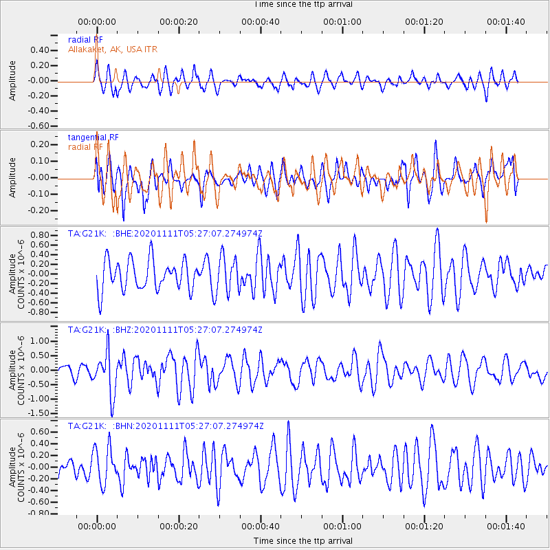
G21K Allakaket, AK, USA - Earthquake Result Viewer
*The percent match for this event was below the threshold and hence no stack was calculated.
| Earthquake location: |
Volcano Islands, Japan Region |
| Earthquake latitude/longitude: |
25.5/142.8 |
| Earthquake time(UTC): |
2020/11/11 (316) 05:17:56 GMT |
| Earthquake Depth: |
10 km |
| Earthquake Magnitude: |
5.7 Mww |
| Earthquake Catalog/Contributor: |
NEIC PDE/us |
|
| Network: |
TA USArray Transportable Network (new EarthScope stations) |
| Station: |
G21K Allakaket, AK, USA |
| Lat/Lon: |
66.52 N/153.51 W |
| Elevation: |
446 m |
|
| Distance: |
56.5 deg |
| Az: |
25.531 deg |
| Baz: |
256.461 deg |
| Ray Param: |
$rayparam |
*The percent match for this event was below the threshold and hence was not used in the summary stack. |
|
| Radial Match: |
50.920387 % |
| Radial Bump: |
400 |
| Transverse Match: |
57.52864 % |
| Transverse Bump: |
400 |
| SOD ConfigId: |
23341671 |
| Insert Time: |
2020-11-25 06:35:32.348 +0000 |
| GWidth: |
2.5 |
| Max Bumps: |
400 |
| Tol: |
0.001 |
|
Signal To Noise
| Channel | StoN | STA | LTA |
| TA:G21K: :BHZ:20201111T05:27:07.274974Z | 3.644653 | 7.409679E-7 | 2.0330272E-7 |
| TA:G21K: :BHN:20201111T05:27:07.274974Z | 0.8192323 | 3.1736988E-7 | 3.8739915E-7 |
| TA:G21K: :BHE:20201111T05:27:07.274974Z | 1.1850768 | 3.627086E-7 | 3.0606336E-7 |
| Arrivals |
| Ps | |
| PpPs | |
| PsPs/PpSs | |


