You are here: Home > Network List > US - United States National Seismic Network Stations List
> Station AMTX Amarillo, Texas, USA > Earthquake Result Viewer
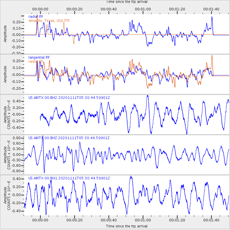
AMTX Amarillo, Texas, USA - Earthquake Result Viewer
*The percent match for this event was below the threshold and hence no stack was calculated.
| Earthquake location: |
Volcano Islands, Japan Region |
| Earthquake latitude/longitude: |
25.5/142.8 |
| Earthquake time(UTC): |
2020/11/11 (316) 05:17:56 GMT |
| Earthquake Depth: |
10 km |
| Earthquake Magnitude: |
5.7 Mww |
| Earthquake Catalog/Contributor: |
NEIC PDE/us |
|
| Network: |
US United States National Seismic Network |
| Station: |
AMTX Amarillo, Texas, USA |
| Lat/Lon: |
34.53 N/101.41 W |
| Elevation: |
1010 m |
|
| Distance: |
94.8 deg |
| Az: |
48.224 deg |
| Baz: |
305.259 deg |
| Ray Param: |
$rayparam |
*The percent match for this event was below the threshold and hence was not used in the summary stack. |
|
| Radial Match: |
50.47981 % |
| Radial Bump: |
400 |
| Transverse Match: |
66.20497 % |
| Transverse Bump: |
400 |
| SOD ConfigId: |
23341671 |
| Insert Time: |
2020-11-25 06:37:32.614 +0000 |
| GWidth: |
2.5 |
| Max Bumps: |
400 |
| Tol: |
0.001 |
|
Signal To Noise
| Channel | StoN | STA | LTA |
| US:AMTX:00:BHZ:20201111T05:30:44.59901Z | 2.0841343 | 4.6018638E-7 | 2.2080458E-7 |
| US:AMTX:00:BH1:20201111T05:30:44.59901Z | 1.3285279 | 2.5902267E-7 | 1.9496969E-7 |
| US:AMTX:00:BH2:20201111T05:30:44.59901Z | 1.2449621 | 1.7013376E-7 | 1.3665777E-7 |
| Arrivals |
| Ps | |
| PpPs | |
| PsPs/PpSs | |


