KOM Kota Tinggi - Earthquake Result Viewer
Earthquake location: Loyalty Islands
Earthquake latitude/longitude: -20.1/168.9
Earthquake time(UTC): 2008/04/09 (100) 12:46:12 GMT
Earthquake Depth: 33 km
Earthquake Magnitude: 6.3 MB, 7.3 MS, 7.3 MW, 7.3 MW
Earthquake Catalog/Contributor: WHDF/NEIC
Network: MY Malaysian National Seismic Network
Station: KOM Kota Tinggi
Lat/Lon: 1.79 N/103.85 E
Elevation: 49 m
Distance: 67.3 deg
Az: 280.812 deg
Baz: 112.517 deg
Ray Param: 0.056990825
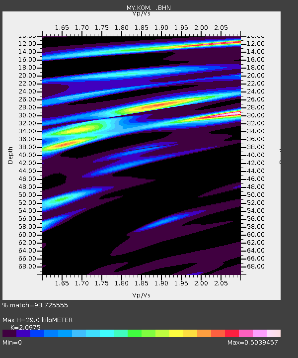
Estimated Moho Depth: 29.0 km
Estimated Crust Vp/Vs: 2.10
Assumed Crust Vp: 6.24 km/s
Estimated Crust Vs: 2.975 km/s
Estimated Crust Poisson's Ratio: 0.35
Radial Match: 98.725555 %
Radial Bump: 190
Transverse Match: 90.94401 %
Transverse Bump: 400
SOD ConfigId: 2504
Insert Time: 2010-03-09 03:31:22.242 +0000
GWidth: 2.5
Max Bumps: 400
Tol: 0.001

Signal To Noise

ChannelStoNSTALTA
MY:KOM: :BHN:20080409T12:56:33.370024Z5.5907118.018386E-71.4342336E-7
MY:KOM: :BHE:20080409T12:56:33.370024Z2.85191182.465481E-78.6450115E-8
MY:KOM: :BHZ:20080409T12:56:33.370024Z3.71417763.3510574E-79.022341E-8
Arrivals
Ps5.3 SECOND
PpPs14 SECOND
PsPs/PpSs19 SECOND