You are here: Home > Network List > TA - USArray Transportable Network (new EarthScope stations) Stations List
> Station M31M Drury Creek, Yukon, CA > Earthquake Result Viewer
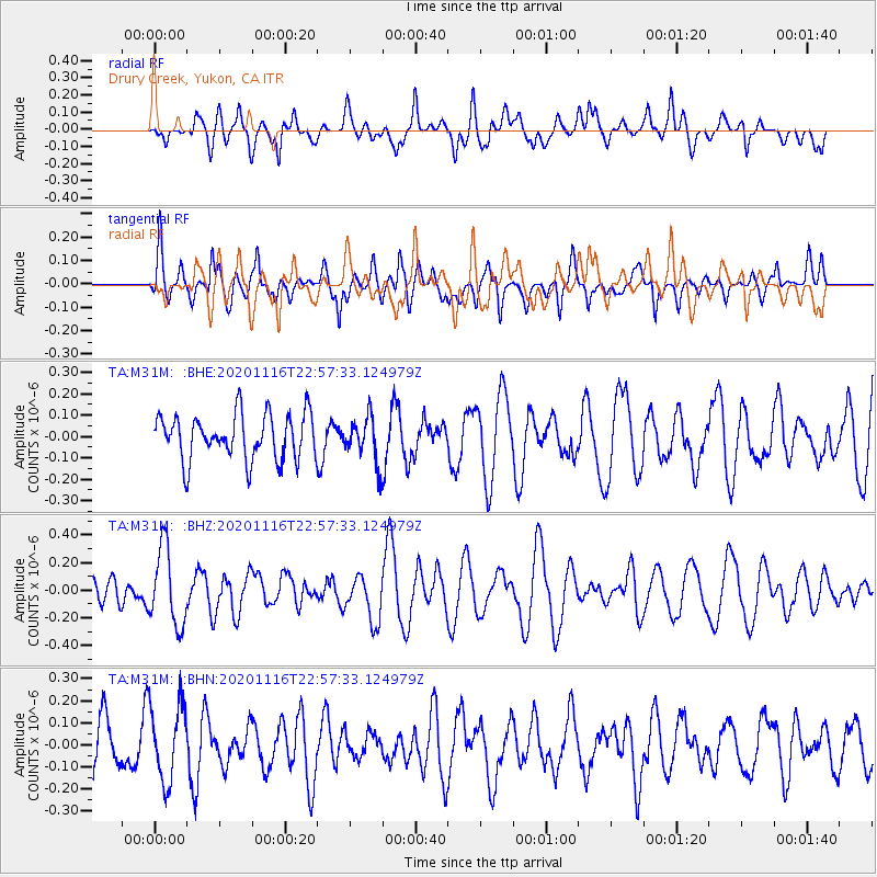
M31M Drury Creek, Yukon, CA - Earthquake Result Viewer
*The percent match for this event was below the threshold and hence no stack was calculated.
| Earthquake location: |
Solomon Islands |
| Earthquake latitude/longitude: |
-7.0/155.7 |
| Earthquake time(UTC): |
2020/11/16 (321) 22:45:22 GMT |
| Earthquake Depth: |
33 km |
| Earthquake Magnitude: |
5.5 Mww |
| Earthquake Catalog/Contributor: |
NEIC PDE/us |
|
| Network: |
TA USArray Transportable Network (new EarthScope stations) |
| Station: |
M31M Drury Creek, Yukon, CA |
| Lat/Lon: |
62.20 N/134.39 W |
| Elevation: |
639 m |
|
| Distance: |
87.0 deg |
| Az: |
26.154 deg |
| Baz: |
248.95 deg |
| Ray Param: |
$rayparam |
*The percent match for this event was below the threshold and hence was not used in the summary stack. |
|
| Radial Match: |
56.93283 % |
| Radial Bump: |
400 |
| Transverse Match: |
51.5914 % |
| Transverse Bump: |
400 |
| SOD ConfigId: |
23341671 |
| Insert Time: |
2020-11-30 23:55:58.208 +0000 |
| GWidth: |
2.5 |
| Max Bumps: |
400 |
| Tol: |
0.001 |
|
Signal To Noise
| Channel | StoN | STA | LTA |
| TA:M31M: :BHZ:20201116T22:57:33.124979Z | 2.0754514 | 2.7822026E-7 | 1.3405288E-7 |
| TA:M31M: :BHN:20201116T22:57:33.124979Z | 1.1285427 | 1.743043E-7 | 1.5445079E-7 |
| TA:M31M: :BHE:20201116T22:57:33.124979Z | 0.9936883 | 1.05722705E-7 | 1.0639423E-7 |
| Arrivals |
| Ps | |
| PpPs | |
| PsPs/PpSs | |


