You are here: Home > Network List > G - GEOSCOPE Stations List
> Station TAOE Taiohae, Marquises islands > Earthquake Result Viewer
TAOE Taiohae, Marquises islands - Earthquake Result Viewer
*The percent match for this event was below the threshold and hence no stack was calculated.
| Earthquake location: |
Central Mexico |
| Earthquake latitude/longitude: |
18.6/-98.5 |
| Earthquake time(UTC): |
2017/09/19 (262) 18:14:38 GMT |
| Earthquake Depth: |
51 km |
| Earthquake Magnitude: |
7.1 Mww |
| Earthquake Catalog/Contributor: |
NEIC PDE/us |
|
| Network: |
G GEOSCOPE |
| Station: |
TAOE Taiohae, Marquises islands |
| Lat/Lon: |
8.85 S/140.15 W |
| Elevation: |
800 m |
|
| Distance: |
49.3 deg |
| Az: |
240.038 deg |
| Baz: |
56.27 deg |
| Ray Param: |
$rayparam |
*The percent match for this event was below the threshold and hence was not used in the summary stack. |
|
| Radial Match: |
89.56522 % |
| Radial Bump: |
400 |
| Transverse Match: |
75.719315 % |
| Transverse Bump: |
400 |
| SOD ConfigId: |
2341311 |
| Insert Time: |
2017-10-03 18:32:16.725 +0000 |
| GWidth: |
2.5 |
| Max Bumps: |
400 |
| Tol: |
0.001 |
|
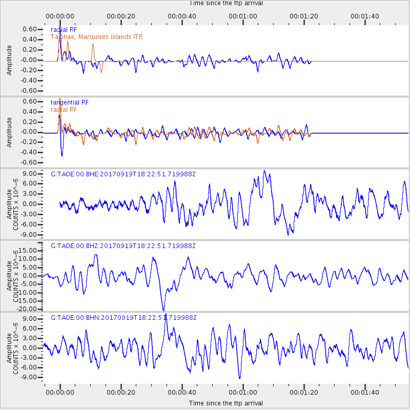
Signal To Noise
| Channel | StoN | STA | LTA |
| G:TAOE:00:BHZ:20170919T18:22:51.719988Z | 3.1532035 | 3.5385922E-6 | 1.1222213E-6 |
| G:TAOE:00:BHN:20170919T18:22:51.719988Z | 1.9380276 | 1.6344501E-6 | 8.4335744E-7 |
| G:TAOE:00:BHE:20170919T18:22:51.719988Z | 2.6653078 | 2.4126657E-6 | 9.0521087E-7 |
| Arrivals |
| Ps | |
| PpPs | |
| PsPs/PpSs | |


