You are here: Home > Network List > US - United States National Seismic Network Stations List
> Station DGMT Dagmar, Montana, USA > Earthquake Result Viewer
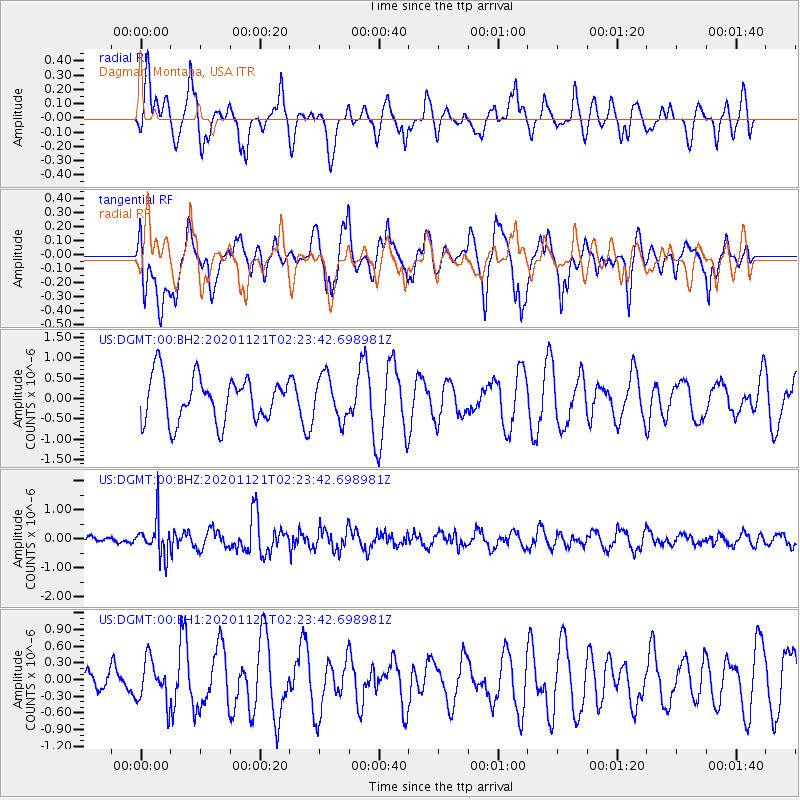
DGMT Dagmar, Montana, USA - Earthquake Result Viewer
*The percent match for this event was below the threshold and hence no stack was calculated.
| Earthquake location: |
Near Coast Of Central Chile |
| Earthquake latitude/longitude: |
-30.9/-71.5 |
| Earthquake time(UTC): |
2020/11/21 (326) 02:11:47 GMT |
| Earthquake Depth: |
54 km |
| Earthquake Magnitude: |
5.6 Mww |
| Earthquake Catalog/Contributor: |
NEIC PDE/us |
|
| Network: |
US United States National Seismic Network |
| Station: |
DGMT Dagmar, Montana, USA |
| Lat/Lon: |
48.47 N/104.20 W |
| Elevation: |
0.0 m |
|
| Distance: |
84.3 deg |
| Az: |
338.823 deg |
| Baz: |
152.187 deg |
| Ray Param: |
$rayparam |
*The percent match for this event was below the threshold and hence was not used in the summary stack. |
|
| Radial Match: |
58.982464 % |
| Radial Bump: |
400 |
| Transverse Match: |
44.00076 % |
| Transverse Bump: |
400 |
| SOD ConfigId: |
23341671 |
| Insert Time: |
2020-12-05 03:29:08.584 +0000 |
| GWidth: |
2.5 |
| Max Bumps: |
400 |
| Tol: |
0.001 |
|
Signal To Noise
| Channel | StoN | STA | LTA |
| US:DGMT:00:BHZ:20201121T02:23:42.698981Z | 1.8322057 | 6.1319923E-7 | 3.3467816E-7 |
| US:DGMT:00:BH1:20201121T02:23:42.698981Z | 0.6867399 | 3.8742286E-7 | 5.6414785E-7 |
| US:DGMT:00:BH2:20201121T02:23:42.698981Z | 0.9622514 | 5.292204E-7 | 5.499814E-7 |
| Arrivals |
| Ps | |
| PpPs | |
| PsPs/PpSs | |


