You are here: Home > Network List > US - United States National Seismic Network Stations List
> Station HAWA Hanford, Washington, USA > Earthquake Result Viewer
HAWA Hanford, Washington, USA - Earthquake Result Viewer
*The percent match for this event was below the threshold and hence no stack was calculated.
| Earthquake location: |
Central Mexico |
| Earthquake latitude/longitude: |
18.6/-98.5 |
| Earthquake time(UTC): |
2017/09/19 (262) 18:14:38 GMT |
| Earthquake Depth: |
51 km |
| Earthquake Magnitude: |
7.1 Mww |
| Earthquake Catalog/Contributor: |
NEIC PDE/us |
|
| Network: |
US United States National Seismic Network |
| Station: |
HAWA Hanford, Washington, USA |
| Lat/Lon: |
46.39 N/119.53 W |
| Elevation: |
364 m |
|
| Distance: |
32.7 deg |
| Az: |
332.652 deg |
| Baz: |
140.975 deg |
| Ray Param: |
$rayparam |
*The percent match for this event was below the threshold and hence was not used in the summary stack. |
|
| Radial Match: |
94.18561 % |
| Radial Bump: |
277 |
| Transverse Match: |
67.2147 % |
| Transverse Bump: |
400 |
| SOD ConfigId: |
2341311 |
| Insert Time: |
2017-10-03 18:35:57.412 +0000 |
| GWidth: |
2.5 |
| Max Bumps: |
400 |
| Tol: |
0.001 |
|
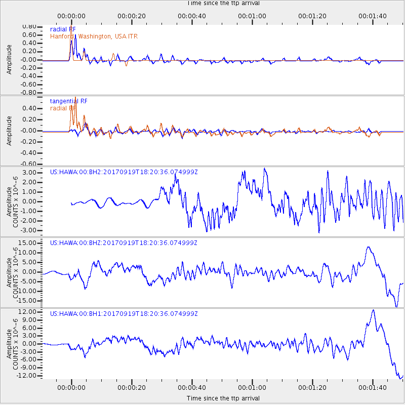
Signal To Noise
| Channel | StoN | STA | LTA |
| US:HAWA:00:BHZ:20170919T18:20:36.074999Z | 8.239258 | 3.7472637E-6 | 4.5480598E-7 |
| US:HAWA:00:BH1:20170919T18:20:36.074999Z | 7.7361283 | 2.1342212E-6 | 2.7587717E-7 |
| US:HAWA:00:BH2:20170919T18:20:36.074999Z | 5.9489784 | 1.4180799E-6 | 2.3837369E-7 |
| Arrivals |
| Ps | |
| PpPs | |
| PsPs/PpSs | |


